Time was when hinterlands were confined to geography lessons, but the Aussies love them, and there's a lot of them about. Near here, there's a Sunshine Coast hinterland and a Gold Coast hinterland and a Byron Bay hinterland and doubtless many more. I am not qualified to define where they begin or end, or how big a town or city has to be to qualify for a hinterland, but I do know that the Blackall Range, where we spent the extra-long Easter break, is a dominant feature of the Sunshine Coast hinterland.
The mountain range was first visited by a big name in early Australian exploration – Ludwig Leichhardt. I'm going to digress a bit here because his story is an interesting one. He arrived in Sydney from Prussia (Germany) in 1842 with the intention of exploring the interior. First he studied the geology of the Hunter Valley and the fauna and flora of the east coast from Newcastle to Moreton Bay. But his aim was to join a government-sponsored expedition overland to Port Essington, north of where Darwin is today, which was important for trade with Asia. When this didn't materialise, he found private backers and persuaded volunteers to accompany him. He left Jimbour in Queensland's Darling Downs in October 1844.
After a journey overland of nearly 4,800 kilometres, during which he discovered important rivers and recorded everything he found of interest, Leichhardt reached Port Essington 14 months later. He arrived back in Sydney (by boat) the following year and received a hero's welcome from people who had thought he was long dead. Next he had an even bigger plan: to travel across the continent to the west coast. With a government grant this time, and private backing, he left the Darling Downs at the end of 1846, but was forced back, after covering some 800km in six months, by bad weather, sickness and lack of food.
In March 1848, he set off again for the west coast, starting from the Condamine River in Queensland. He was last seen in April in the Darling Downs. His expedition had been expected to take two to three years so he was not presumed to have perished for many years. The New South Wales government sent search expeditions in 1852 and 1856 but, apart from a few 'L's carved on trees here and there, hard evidence of Leichhardt's demise illuded them. In the 1860s there were further searches, and Leichhardt's fate was never far from explorers' minds. In 1896, David Carnegie from Western Australia was exploring the Gibson and Great Sandy deserts when he came across Aborigines who had artefacts Carnegie believed had once belonged to Leichhardt.
Then, around the turn of the century, an Aborigine stockman not far from Sturt Creek in northwest WA found a small brass nameplate bearing Leichhardt's full name and the year 1848. It was attached to the burnt remains of a shotgun hanging in a baobab tree that was marked with an L. In 2006 the nameplate was finally authenticated by historians and scientists as belonging to the German explorer. We may not know when or how Leichhardt died, but we do know now that he made it almost two-thirds of the way across the continent, a remarkable feat. He had never intended to travel in a line from east to west, across vast swathes of desert, but to follow a great arc from Queensland to the Swan River, following the head waters of rivers draining into the Gulf of Carpentaria and to the north coast. He had then hoped to find a southwesterly flowing system to take him towards the Swan. Some of those L-marked trees found earlier were near the Flinders River; and Sturt Creek flows to the southwest, albeit an awful long way from Leichhardt's intended destination.
Today, in honour of this man, there is a suburb in Sydney, a highway in Queensland, a river in Queensland, a suburb of Ipswich (west of Brisbane), an electoral district in the House of Representatives and even a Eucalyptus leichhardtii.
So Leichhardt was here, in the Sunshine Coast hinterland, before us. This was my second choice, as it was his. I had wanted to go to the Bunya Mountains, slightly more off the beaten track, but everywhere insisted that we stay four nights over this Easter-with-Anzac-Day-tacked-on weekend at the end of April. (Actually, it was more like Anzac Day – probably the most important day in the Oz calendar after Australia Day – with Easter tacked on.) The Bunyas are probably lovely, but I wasn't sure there was enough to do there for five days; besides which, three nights was what we wanted.
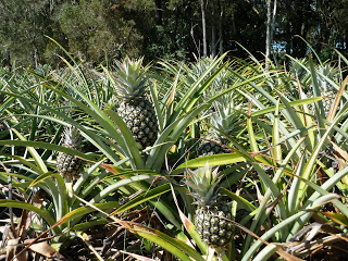
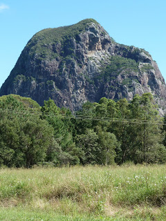
The Bruce Highway was slow-going – two idiots had had a shunt somewhere south of Burpengary. We turned off on to the Steve Irwin Way, and passed pineapple fields, which are still a source of wonder to me, and the first mighty Glass House Mountain – Mt Beerburrum.
We drove to Maleny for lunch, but most of the little town was closed for Good Friday. Some places were open for the morning only. Every day over the long weekend was guesswork as far as opening hours were concerned. Was Monday Easter Monday or Easter Monday and Anzac Day, which has to be on the 25th (and you have to close in the morning); in which case was the holiday on Tuesday Easter Monday deferred, or a holiday in lieu of Anzac Day because Monday was a holiday anyway? Of course, if Easter were fixed*, and earlier, then it wouldn't clash with Anzac Day and everyone wouldn't have to ask the same old question for the first three months of the year.
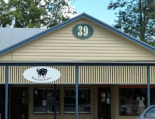
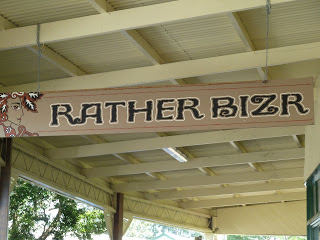
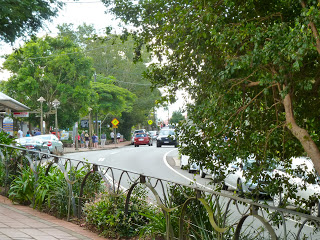
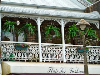
Maleny has a colourful high street with lots of cutesy little shops.
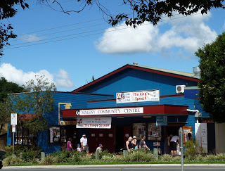
It's even got a 'sustainable' bank (Maleny Credit Union), which looks suitably little-cabin-in-the-forest.

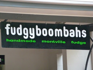
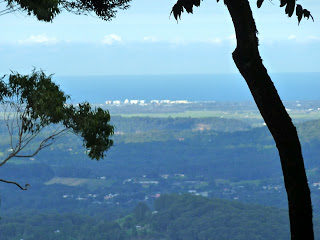
Montville, about 15km further north, is cuter still. It's main drag is more up-and-downy, and it has more greenery, prettier buildings and lovely views to the Sunshine Coast from cafes on the right side of the street.
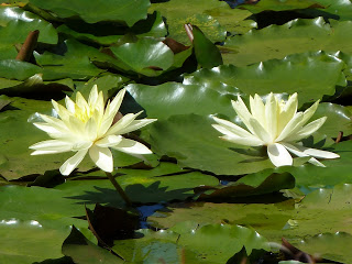
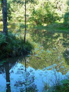
Things come in threes, and Mapleton is 9km further north still. It is much smaller, with a splendid lily pond and some falls that are rather difficult to see.
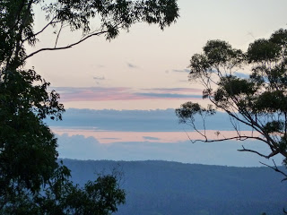
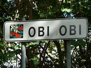
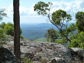
We were staying about 9km out of town along Delicia Road in a lovely cabin at Coolabine Ridge Eco Sanctuary. It was a beautiful evening and we looked out over the Obi Obi Valley as the sun set. After steak on the barbeque, we went stargazing: with only slight light pollution in the east from the coast, the magnificent Milky Way dripped its ancient light over the Blackall Range.

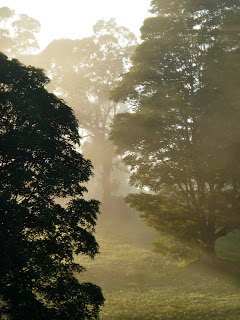
When you're staying in an idyllic spot, there is little incentive to get up and get on. We decided to explore some of Coolabine Ridge's very-well-maintained 400 acres before cooking breakfast on our verandah. Oh, what a beautiful morning it was.
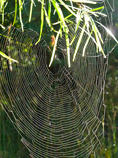
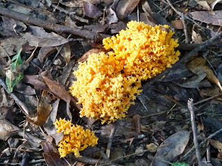
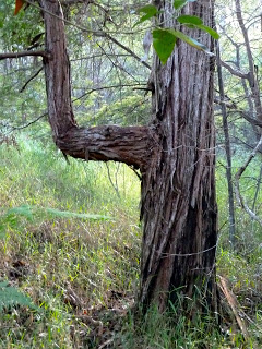
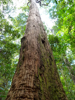
Natural wonders of note included fungus that resembled coral and a right-angle tree.
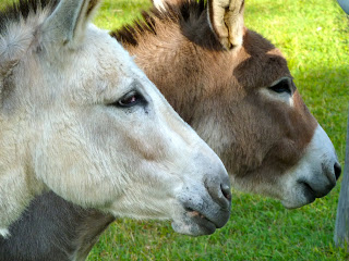
There were even some of these... and they loved apples.
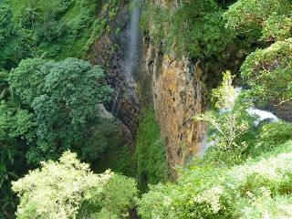
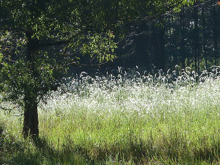
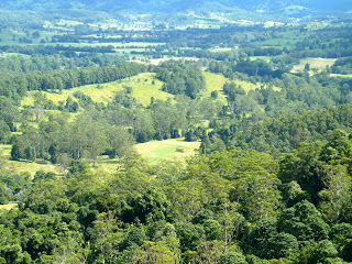
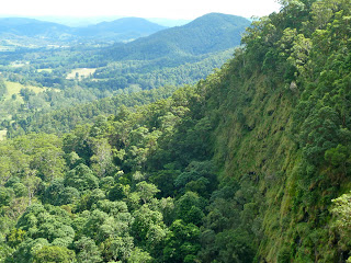
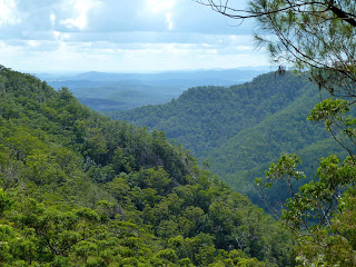
The Blackall Range was created by volcanic activity 25-30 million years ago, but has since been eroded by water, forming ridges and waterfalls cascading over the escarpment edge. Rich basalt soils once supported large tracts of warm subtropical rainforest, but only remnants remain, protected in national parks.
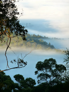
In the Mapleton Falls National Park we walked the Wompoo circuit, which is only short (1.3km). We didn't hear the Wompoo Fruit Dove but Whipbirds and Bell Miners instead, and there were very fine Piccabeen palms in a creek. As usual, most visitors confined themselves to the first couple of hundred metres of the walk or the picnic area so we had the circuit to ourselves. Although the view of the waterfall from the lookout was anything but 'spectacular' (maybe the park rangers need to cut back a few branches), the Obi Obi Valley was a study in lush greens.

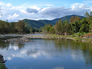
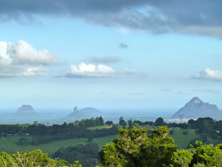
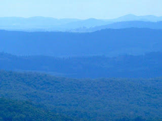
If you continue along the Obi Obi road from Mapleton Falls, you can drive a circular route through some lovely country. First up is Kenilworth, a pleasant little town on the Mary River. The road follows the river to Canondale, and then continues to Witta and Maleny. Make a detour at Maleny to drive along Mountain View Road for wonderful distant views of the Glass House Mountains. If you've got time, visit the Mary Cairncross Scenic Reserve, where the rainforest track is well worth walking, early in the day preferably. From Maleny, you can complete the drive via Montville and back to Mapleton.
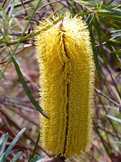
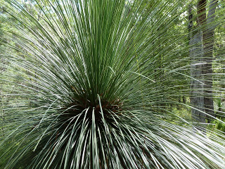
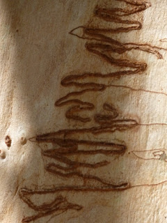
We were staying very close to the most northerly part of the Sunshine Coast Hinterland Great Walk – the Delicia Section. It's 14km in total, but we just dipped in for about about five or six kilometres. We joined the track a kilometre or so before the Thilba Thalba walkers camp and walked as far as Gheerula Bluff. This was open Scribbly Gum forest rather than thick rainforest: there were fine examples of Banksias, Grass Trees and scribbles.
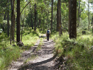
We kind of wished we had got our act together to do the full day's walk, but this was supposed to be a chilling holiday, during which we spent long periods gazing at lovely views and contemplating what Leichhardt must have thought as he tried to find his way through endless upland barriers on his way across this continent.
* as opposed to being on the Sunday following the paschal full moon, that is the full moon that occurs on or after the March equinox. The paschal full moon was the date of Passover in the Jewish calendar, which is allegedly when the last supper took place