A vast and sparkling inland sea
The Channel Country of far western Queensland was on my to-do list from the moment I read about ephemeral waterways in Australian deserts. During our years in Queensland there raged a debate about the need for ‘Wild Rivers’ legislation to protect pristine rivers in remaining areas of wilderness. Such laws came and went, according to who was in power at the time (see here and here). There are wild rivers on the Cape York Peninsula that I have yet to see, so my heart belongs to the Diamantina and Georgina rivers and Cooper and Eyre creeks of the Channel Country. When northern Australia gets a decent Wet, floodwaters drain south and interstate in these big rivers. Many Channel Country creeks, however, are small and waterless much of the time.
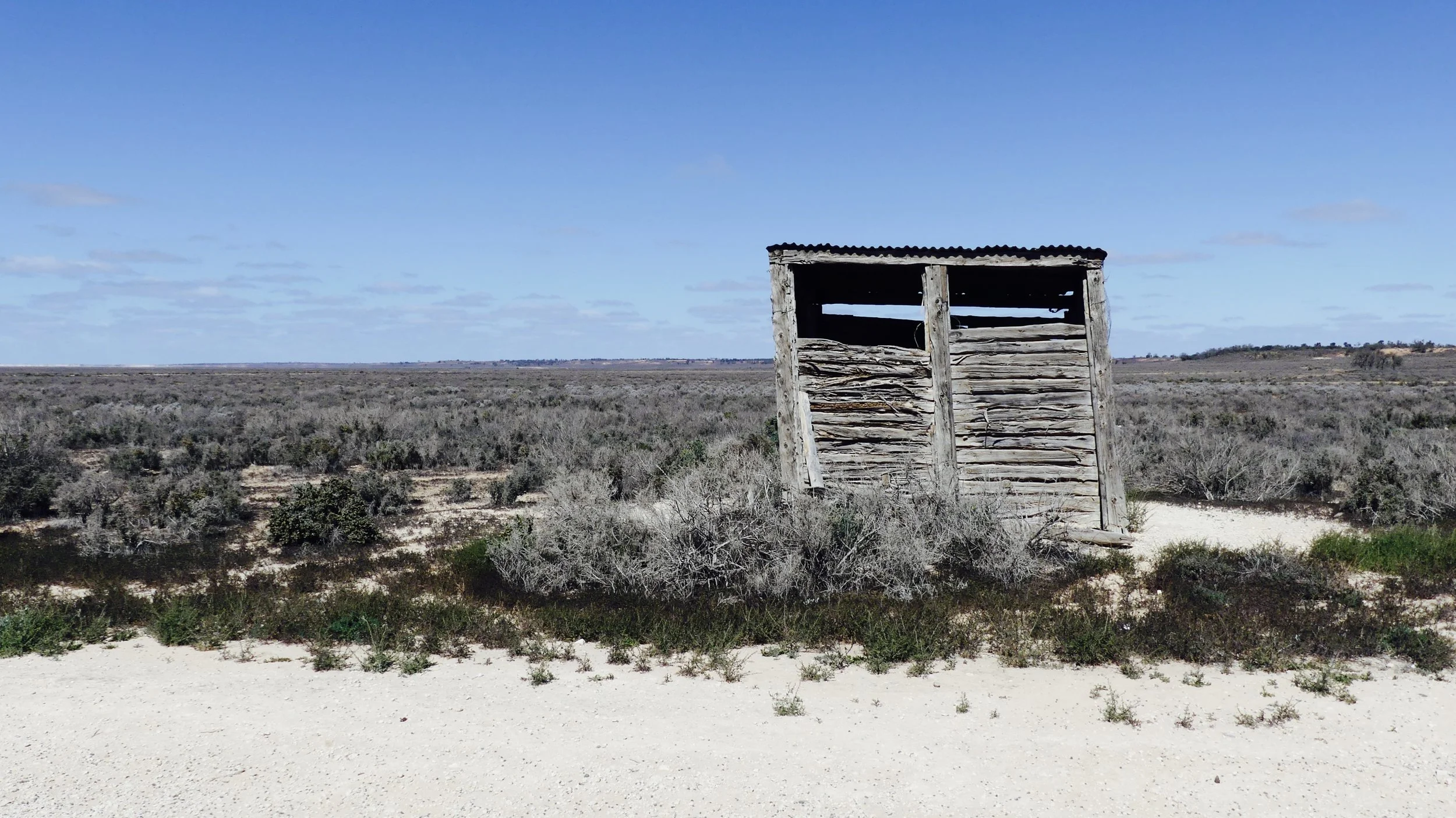
On our Outback trips, my friend would ask why I kept taking photos similar to the ones below. The reason was, they were evidence of intermittent water flow in what are essentially dry zones. You can’t travel around, of course, when the channels are flowing high: unsealed roads are easily cut. So you either have to look down from above or use your imagination during the Dry. You can easily spot channels up ahead: lines of trees and scrub stand out in an otherwise sparsely vegetated landscape.
In 2014, we flew from Birdsville south over the Goyder Lagoon, a large ephemeral swamp in northern South Australia. We were overflying the Lake Eyre Basin all the way (see diagram below). There was no water in Lake Eyre that particular year, however: it’s a rare occurrence, dependent on weeks, if not months, of steadily trickling water reaching the lowest point on the Australian continent. We didn’t make it that far south on that trip, but on the return to Birdsville we followed the course of the mighty Diamantina, which wasn’t in flood but still impressive in its parched, almost-desert surroundings.
Diamantina River
This year, two far-away rain events resulted in the biggest filling of Lake Eyre since 1974. In late January and early February a monsoonal low-pressure system over northern Queensland caused devastating flooding in the east. Townsville’s rain gauge measured 1052.8 mm during the seven days to 4 February. Further west, parts of the Diamantina catchment copped 300-500 mm. Serious rains weren’t done with Queensland, however. In March, ex-Tropical Cyclone Trevor wreaked more havoc in central and southwestern parts that had been in drought for six years, and whose hard-baked surfaces couldn’t soak up water fast enough. Hundreds of thousands of cattle perished. Farmers had struggled to keep them alive for years as feed became scarce during the drought: now, debilitated animals couldn’t withstand rapidly rising floodwaters.
(By the way, a cyclone becomes an ‘ex’ when it tracks over land rather than sea.)
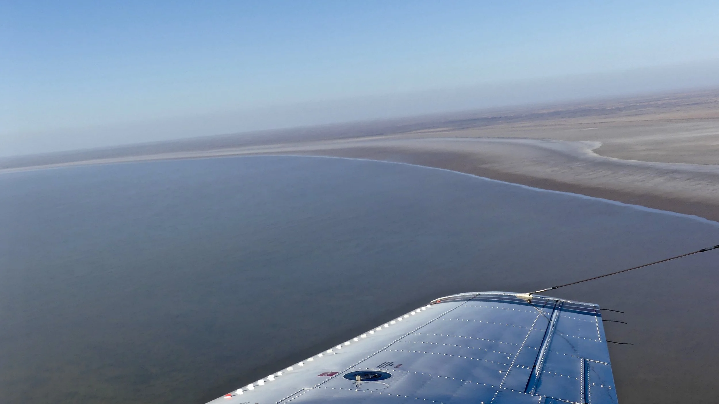
When I lived in Brisbane, I pondered how to make a quick dash to Lake Eyre, known by the original inhabitants of the region as Kati Thandi, to see a unique Australian phenomenon. But now I live in south Melbourne, only 15-20 minutes away from Moorabbin Airport, easier options presented themselves. And so it was that early one beautiful Saturday morning at the end of May, we took off for Mildura, in the top left-hand corner of Victoria close to the New South Wales border, where our 7-seater Piper Chieftain had to refuel the first time.
Taking off from Moorabbin
It was a while since I’d done anything remotely adventurous, so everything, but everything, was interesting; from patchworks on approach to Mildura to the crazily meandering Murray on take-off.
The River Murray forms the border between Victoria and New South Wales for 1880 kilometres, from Kosciuszko National Park in the east to Victoria’s most northwesterly point where there’s a strange dog-leg in South Australia’s eastern border. You may need to look at a map for this to make any sense. The SA-NSW border heads due north, straight as a die, just east of that point. We crossed the border about half an hour or so’s flying time northwest of Mildura: it looked like a track but in fact is MVO (management vehicles only).
Baby lenticular clouds?
Looking east across the SA-NSW border
Lunch was at Rawnsley Park Station, just south of Wilpena Pound in the Flinders Ranges. The Woolshed restaurant offered us Rawnsley’s own lamb: it seemed churlish to refuse. I could feel the Outback by now: it had been a long time. Earlier cloud had not developed; it was warmer than Melbourne; and I was already adapting to hopping about in a little plane. The Ranges had caused a bit of turbulence as we landed on Rawnsley Park’s airstrip, but I was becoming an old hand. You’d scarcely have recognised the white-knuckled spook who took off in 2017 from Cambridge Aerodrome near Hobart bound for Tassie’s southwestern wilderness.
The western flank of Wilpena Pound
The Flinders Ranges are a geologist’s dream. South Australia’s largest mountain range stretches for roughly 430 kilometres and consists of a series of dramatically folded and faulted sediments, in two sections, North and South.
After lunch, pilot Jake flew us round to the gorge at the entrance to the Wilpena Pound. It didn’t look like the easiest point of entry to me. My friend got the best pic showing the shape of this natural amphitheatre in its entirety. It measures 17 km by 8 km, and the floor is 200 metres higher than the surrounding country.
We flew on towards William Creek, where we were spending the night. There was one more refuelling stop, at Leigh Creek, which was busy and there was a queue. Loads of Australians fly long distances in little planes, especially at weekends. There were people here who’d popped up 700 kilometres from Adelaide to see water in Lake Eyre. They’d been there that morning but it was cloud covered. I desperately didn’t want that to happen the following day. As we continued northwestwards, there were dry water courses, dramatic outcrops, parallel dunes and geomorphological features I couldn’t begin to explain. Alas, an opencast coal mine, too.
At one point we caught a first glimpse of a distant lake! And a large man on the ground beneath.
Marree Man is 4.2 kilometres tall and a fairly recent (1998) creation
We landed briefly at William Creek and transferred to another plane for the final excitement of the day – the Anna Creek Painted Hills. They are claimed to be recently discovered: in fact, what the promoters mean is, people have only just been allowed on to Anna Creek Station to have a look at them. Our Wrightsair plane was full of flies, the windows were spattered, and I was in the co-pilot’s seat! I observed how to avoid crashing into all other little planes buzzing about: you announce over the airwaves what you’re going to do, in which direction and at what height. If no one shouts backatya, assume you’re good to go. The journey lasted about 25 minutes: there was a certain amount of time pressure; we had to land back in William Creek before dark. Beneath were more parallel dunes and Anna Creek Station, the largest cattle station in the world. The rich, end-of-arvo light was glorious.
Anna Creek Station
Plane number 2
The Painted Hills’ colours were spectacular. The rock, however, is soft and extremely fragile. Privileged visitors should not be allowed to wander at will over the dunes. I was later assured that there are marked paths, but they were not obvious and we weren’t directed along them. Once hoards are carelessly trampling all over them, delicate stacks will soon be demolished.
Above and right: variations on a theme
On take-off, the colours were even more resplendent, the shadows were long and sunset was nigh.
William Creek consists largely of one of the world’s most remote pubs, located about halfway along the Oodnadatta Track. Twelve people live in William Creek with many more Galahs, who were getting ready to roost as we touched down for the last time that day. (Six take-offs and six landings we did in one day!). Most things had a hint of pink by then.
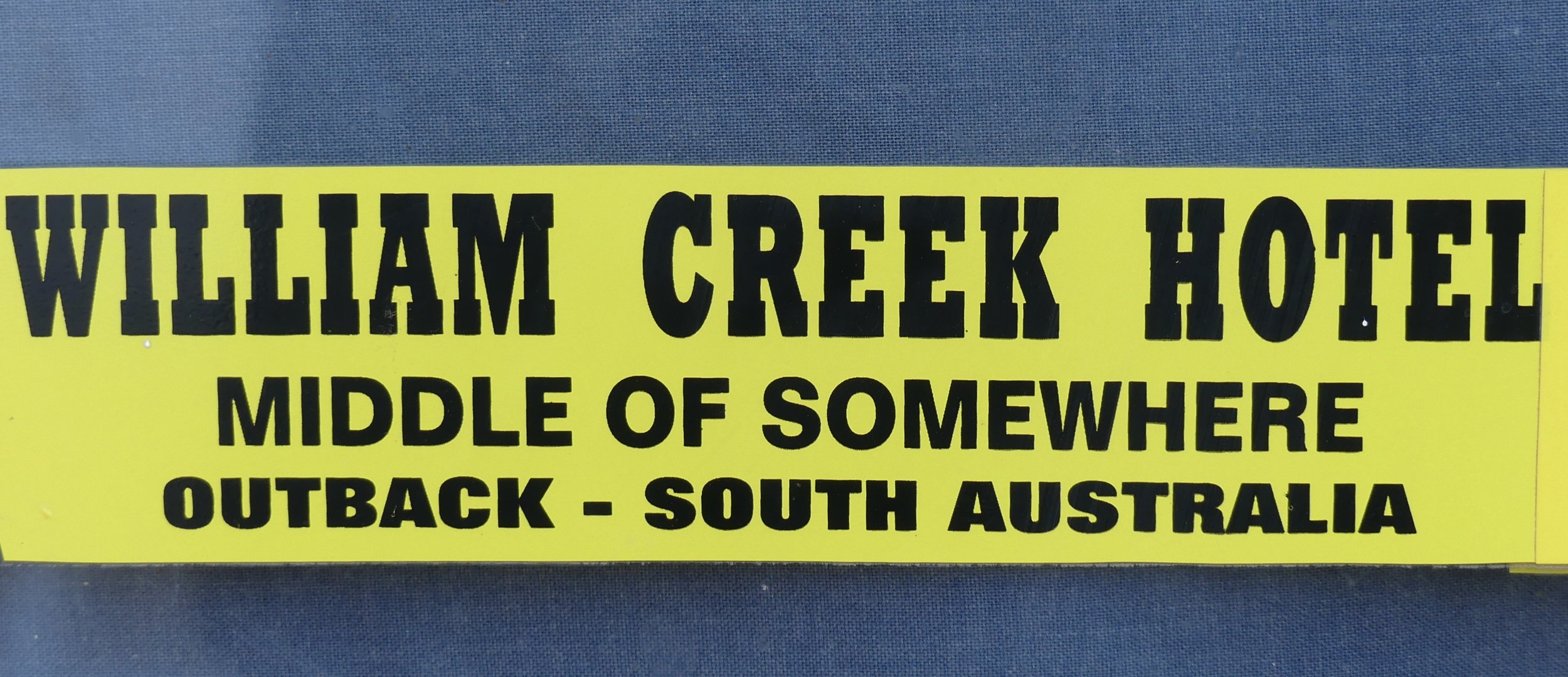
We stayed in one of the Hotel’s cabins, which were basic but adequate for purpose. In front of us was the campsite: note the sticker in our closest neighbours’ van! We joined our fellow travellers in the pub’s lively bar, where we were introduced to Dylan, a young musterer who’d been told to mingle by the boss. With extremely limited experience of mustering, we tried to ask intelligent questions.
Adventure before dementia

The following morning, breakfast was at 7, for an 8 o’clock departure. It was a glorious Outback morning: I liked William Creek. Today was the day, we had sunshine, and there was a great sense of anticipation among people on their way to something special.
Lake Eyre has a total area of 9000 square kilometres and is Australia’s largest salt lake, or salina; and the world’s third largest. It lies between 10 and 15 metres below sea level, and is the lowest part of the Lake Eyre Basin and the continent. The deepest parts are in Belt Bay and Madigan Gulf (see below right), which were between 1.5 and 2 metres deep when we were there. There is a Lake Eyre North – 144 kilometres (long) by 77 – and a Lake Eyre South – 24 by 64, which are joined by the Goyder Channel. Lake Eyre South had no water in it during our visit. The Basin is an area of closed drainage – it has no outlet to the sea – and covers 1.3 million square kilometres, one-sixth of Australia. The greatest volume of water ever known in Lake Eyre since settlement – 32.5 million megalitres – was in 1974 (the year of Brisbane’s big flood). The maximum depth then was an astonishing 6 metres. The Lake has completely filled only twice since then, in 1984 and 1989. Edward John Eyre was the first European to set eyes on Lake Eyre the salt lake, in 1840.
Above: the Lake Eyre Basin and its major rivers
Right: our plane’s route over Lake Eyre
One of the best things about the Lake Eyre Basin is its lack of water regulation. Rivers run free. There are no large irrigation schemes, other water diversions, dams or flood plain developments, although this doesn’t stop people trying to impose regulations of one sort or another. In 1995, locals fought off plans for large-scale irrigated cotton farming in the Cooper Basin. More recently, Queensland’s Palaszczuk government has released tens of thousands of square kilometres in the Eyre Basin for oil and gas exploration, which in inappropriate on so many levels. And a risky business, as Santos found to its cost only this week. For great footage of wild rivers and the need to protect this region, go to https://www.westernrivers.org.au and watch the video entitled The Channel Country is an Iconic Part of the Queensland Outback.
Sometimes water can take 10 months to reach Lake Eyre: this year it took just two months. Two floods within weeks was pretty unusual, too. The Bureau of Meteorology’s Monthly Water Update for May recorded the highest streamflow of the Diamantina River at Birdsville since 1980 (click on the thumbnail maps for more info). I’ll keep an eye out for June’s Water Update. Substantial floodwaters can hang around in the Lake for up to two years.
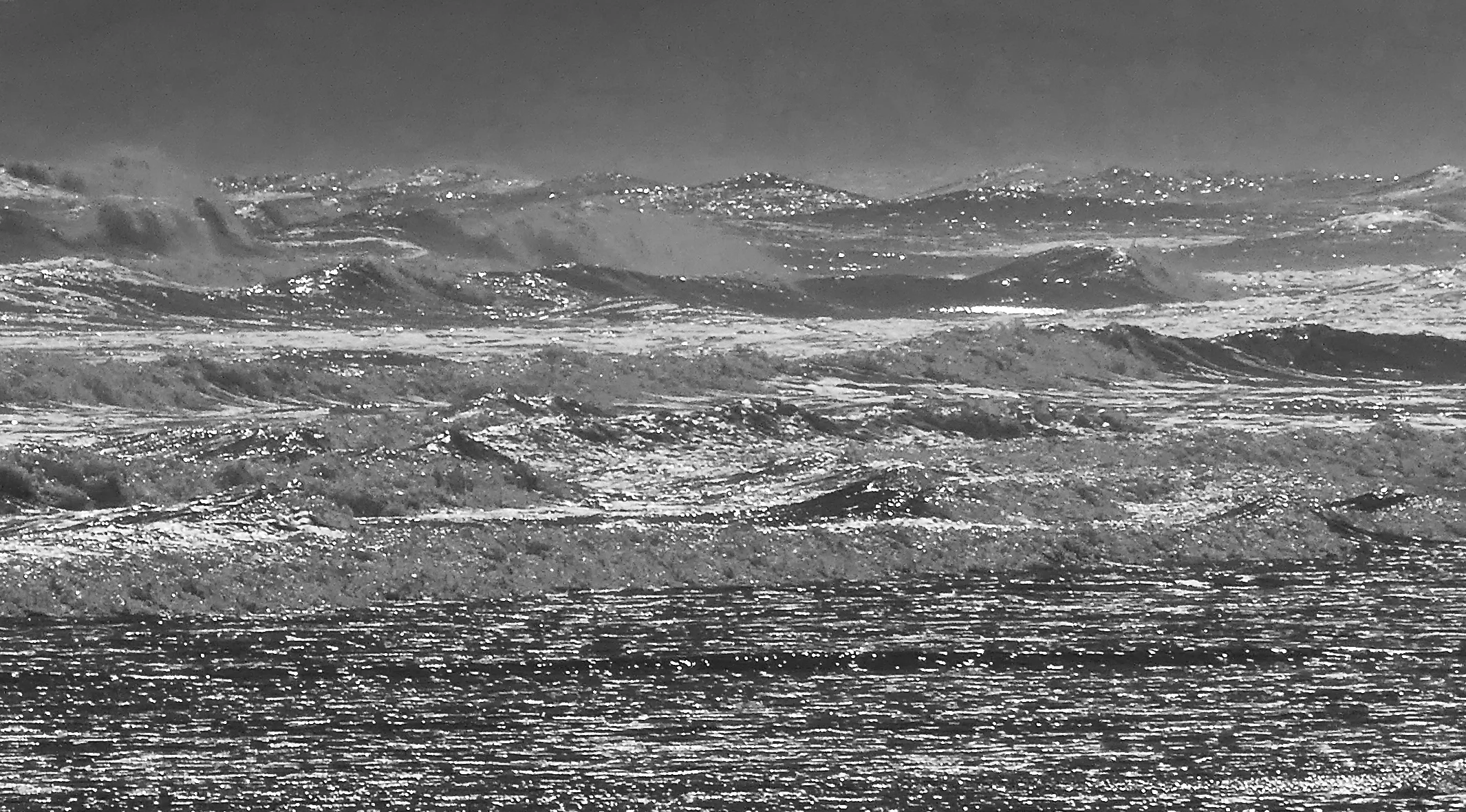
It didn’t take long to get to the Lake. I almost didn’t have camera and phone at the ready. From the outset I didn’t know which way to turn. Jake was very considerate once again: he flew a path that enabled all his passengers to see everything no matter which side of the plane they were sitting. Below us was a stunningly sparkly inland sea. My first thought was for the explorers who had searched for such a thing during the 19th century and whose expeditions ended in frustration. John Eyre may have been the first to see it, but he despaired as he headed back: ‘With bitter feeling of disappointment I turned from the dreary and cheerless scene around me’.
This is the sight that awaited us. It took my breath away.
Silcrete Island
John Eyre was not the only explorer on a mission to locate an inland sea. Charles Sturt, leaving Adelaide in 1844, was so confident he took a whaleboat with him on one expedition into the centre of the continent. Only after suffering terrible hardship and coming up against the relentless dunes of the Simpson Desert did he finally give up the search.
When I look at images from that day, I can’t always decipher exactly what I was photographing. In some I can’t distinguish between water, salt pan and sky; one reminds me of Saturn’s rings.
Of all the pictures, however, the one that excited me the most was the one below: it’s Warburton Inlet, at the top of the Lake. This is what connects the Lake to the Channel Country; where the waters of the Diamantina catchment become Lake Eyre. Beyond its confluence with Eyre Creek in far north South Australia, the Diamantina becomes the Warburton River, the lower reaches of which you see here. The glinting water helps trace the river’s winding course back up north.
And below that is the Warburton Groove, a channel within the Lake down which water flows north to south.
At one point while we were at the top, I zoomed in and pointed opportunistically beyond the Inlet. I never expected anything but a blur to result, given the high chance of reflection from and auto-focussing on the plane’s window. What I got was much more interesting, but I’m afraid I have no idea where it is exactly: let’s say somewhere towards the Simpson Desert!
All too soon we had to leave the Lake behind and head 40 kilometres or so east for morning tea at Muloorina Station. There had been an earlier mention of driving from here to the Lake’s edge, but there was no longer enough time, perhaps because we’d flown as far north as Warburton Inlet. I distracted myself from disappointment by eating our host’s exceptionally delicious cakes. Muloorina runs Hereford cattle, and some of them were nearby in a small enclosure. I meant to photograph them since they were the only animals apart from birds we’d seen on the trip, but we had to get underway sharpish after tea.
As I sat at the kitchen table, I was reminded how, more so than in the city, one should never make assumptions about people’s beliefs in the Outback. Climate science, government ‘experts’, the Greens, killing dingos and respecting Aboriginal customs concerning the Lake were subjects to be left well alone here. I ate more cakes.
Nearby Frome Creek is bore-fed to maintain the water hole for campers
Containers
Still life: table, chair, traffic cone
At this point our trip seemed almost over. Our last stop was Broken Hill, arguably Australia’s most famous Outback town, for lunch. But on the way there was an unexpected delight – Lake Frome – another salina, or salt pan. Its swirly light-and-shade patterns were remarkable. It measures 100 by 40 kilometres and is mostly below sea level. Fifty thousand years ago it was connected to Lake Eyre. Unlike Lake Eyre, it fills rarely, with brackish water from the North Flinders Rangers, whose heart-shaped formation was equally as impressive as Frome’s whitewash.
Above and right: beautiful Lake Frome
Below: clouds and their shadows steal in
Beyond Lake Frome lay the southern Strzelecki Desert, beneath clouds at first, with its own ephemeral water courses.
My biggest regret was that we did not see any birds around the Lake. Jake told us he had not received any reports. In the past there have been thousands; thousands of pelicans alone some years. And sometimes they come from as far afield as Papua New Guinea, as well as the four corners of Australia. How do they know the water has arrived? Other visitors include stilts and swans, gulls and terns; lizards and frogs; and freshwater fish.
On approach to Broken Hill was this 53 MW solar power plant, built in 2015. Which just goes to show, you to don’t have to wait for right-wing state governments to see the light about renewables, you can just get on with it.
In Broken Hill we had lunch at Broken Hill Outback Resort. We waited for pilot Jake to join us, but he was late and looked a little concerned when he arrived. He’d spotted something slightly amiss on the instrument panel after landing and was not prepared to continue until the plane was checked out. There followed a hasty discussion about which of us absolutely had to be back in Melbourne that night: we did not, but Alison had to fly to Sydney first thing Monday morning. So Kirkhope Aviation arranged for a larger plane already returning to base to quickly turn around and come back for us.
In the meantime we had a few hours in Broken Hill: time for a quick dash to the Living Desert and Sculpture park at sundown and dinner in Argent Street. Our new pilot had managed to land at Moorabbin and take off again in a narrow window of relative calm during hours of appalling weather in Melbourne. As we got closer to home the turbulence was alarming, despite my new-found confidence in little planes. We were a few hours later home than scheduled, but it had been a quite extraordinary and thoroughly enjoyable trip. Jake was right: we’d packed so much in, it felt as if we’d been away for days.
And Broken Hill? Well, that’s another story…