
Crossing the Nullarbor
These days we have it easy; in an air-conditioned 4 x 4 with camper-trailer, spare wheels, water tank, roof rack, sturdy storage boxes, portable satellite dish, and all the gizmos and widgets imaginable to make life more comfortable or get out of trouble in remote, inhospitable terrain. Were a wheel to fall off, literally or metaphorically, the chances are you wouldn’t have to sit it out for more than several hours – a day at most – before someone passed by. If you’re pulled over by the side of a remote track, Aussies will slow to ask if you need help; they’ll have a tow-rope to pull you free if you’re bogged; and they’ll share information about signficantly changing conditions ahead.
Nullarbor means ‘no tree’ in Latin. In mostly arid or semi-arid country, the Nullarbor Plain has the world’s largest area of limestone bedrock. At its widest, it stretches 1100 km across South Australia and Western Australia; roughly from Ceduna to Norseman. It’ll take you at least a couple of days to drive, along the Eyre Highway, which is sealed and pretty straight. If it’s hot-hot, you might not want to get out of the car that much. But don’t rush if you don’t have to: crossing a desert can be a mind-bending experience. There are several lookouts to gaze out from, and roadhouses in which to rest or sleep over. The skies at night are unfathomable.
Over the years I’ve read many accounts of early explorers’ treks across Australia. They are never less than tales of grit (guts, resilience, initiative, tenacity), extreme hardship, and stoic suffering. Edward John Eyre was the first European to cross the Nullarbor in 1840-41, part of a journey of almost 2000 km he made from Streaky Bay on the coast of the Great Australian Bight to the new settlement of Albany in Western Australia. Across the Nullarbor, Eyre endured ferocious heat and no water for prolonged periods that verged on unendurable and near-fatal. And his chief assistant, John Baxter, was murdered by two Indigenous members of the party.
In my limited experience – with many mod cons – I found the constant bright glare of unrelenting sun more difficult than high temperatures. I can’t take photographs on either camera or phone with sunnies on and sweat streaming down my face. Constantly screwing up the eyes into slits sooner or later produces mild headache, if you haven’t already got a thumper from the heat.
While researching the topic of endurance, I chanced upon an article from 2019 in Outside, an adventure journal. The piece was entitled What it feels like to die from heatstroke. It made compelling but disturbing reading, about a young man who lost consciousness as his vital organs shut down following exertional hyperthermia. He was found by two travellers who knew what to do to save his life, by rapidly lowering his core temperature. He had previously been warned against trekking where he did, but ignored the advice, obsessively focussing on his objective while over-estimating his fitness. He was extremely fortunate: heatstroke kills thousands of people a year.

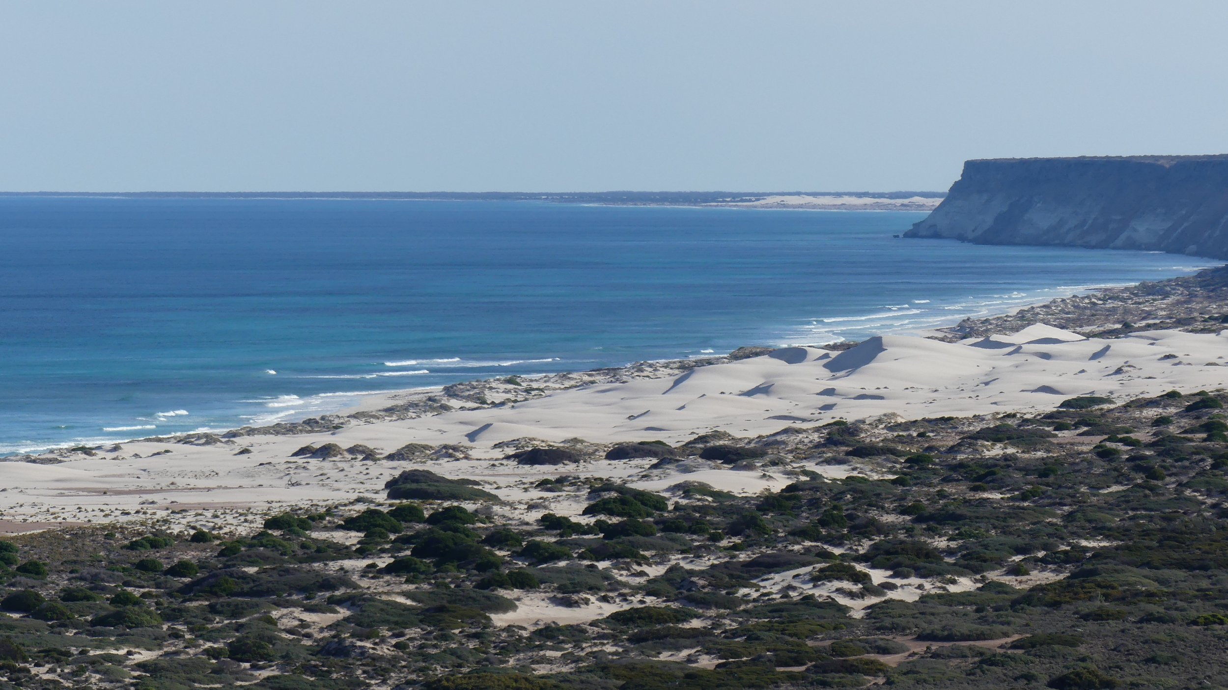
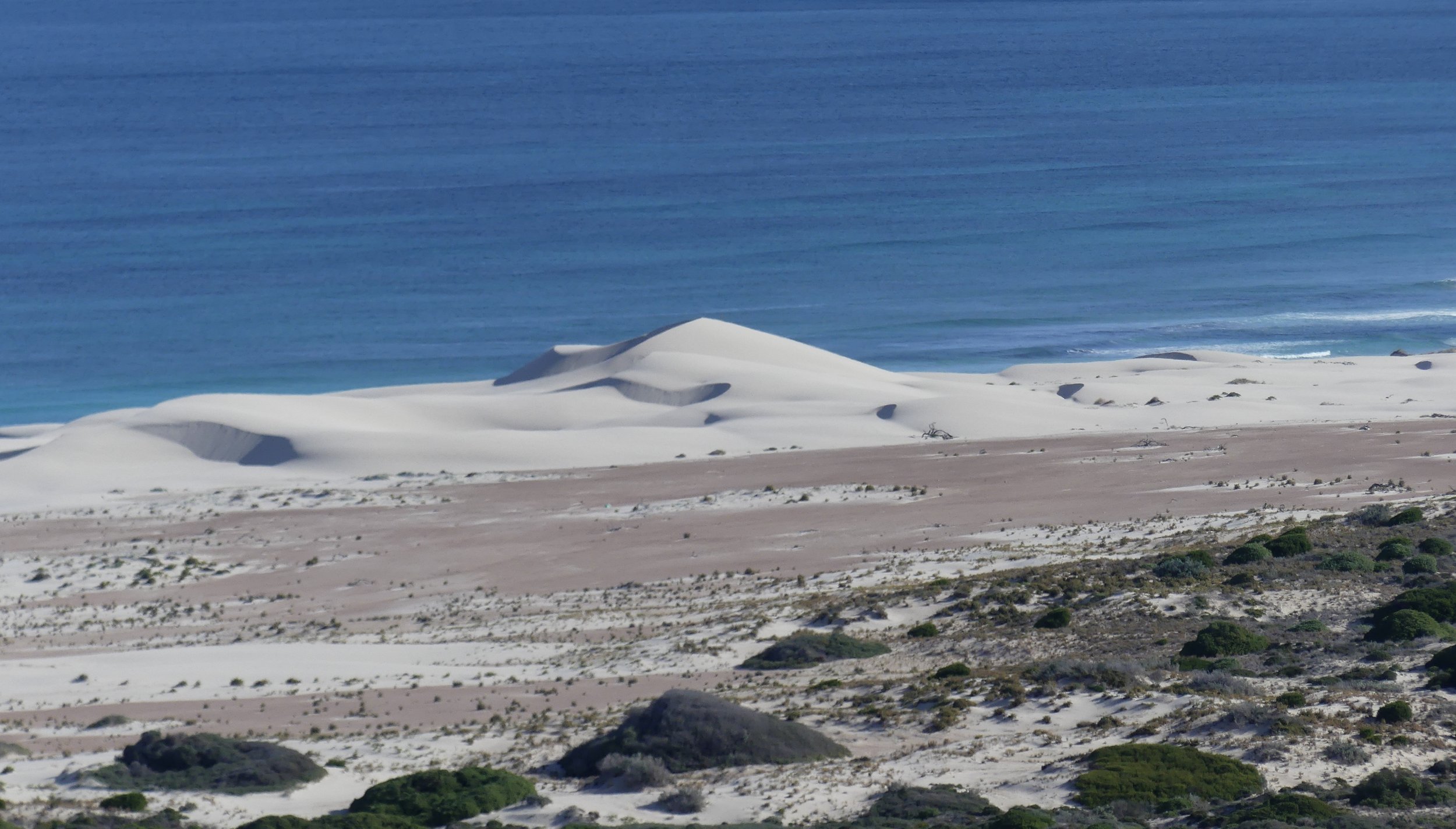
Two views on the way to Ceduna

Streaky Bay to Ceduna (Shelly Beach) 157 km
Slept well; awake just after 6; hearty breakfast at Drift in Streaky Bay; posted honey back east; quick circuit of Cape Bauer headland north of town. The ocean was churning and conditions were ripe for blow-hole activity. We spent a while trying to work out what was producing the best ‘blows’: it didn’t seem to be a set of larger oncoming waves but additional waves to the right of the headland combining. The coastal limestones contain vertical fractures that become enlarged over a long time by chemical reactions with rainfall, and erosion by waves, wind and spray. If the pipes are connected to caves below, waves force air and water vapour upwards.

Blow hole


Wave-cut platform
Ceduna to Nullarbor Roadhouse 324 km
It was bright and sunny but the wind was cold. We struggled to find a service station with a functioning tyre-inflation point. Sleep had been fitful, and then my friend listened to the England vs Denmark match in the Men’s Euros from 04:30. It was a relatively big driving day and we changed drivers frequently. Beyond Ceduna, the Eyre Highway drifts away from the coast.


Big sky, big country

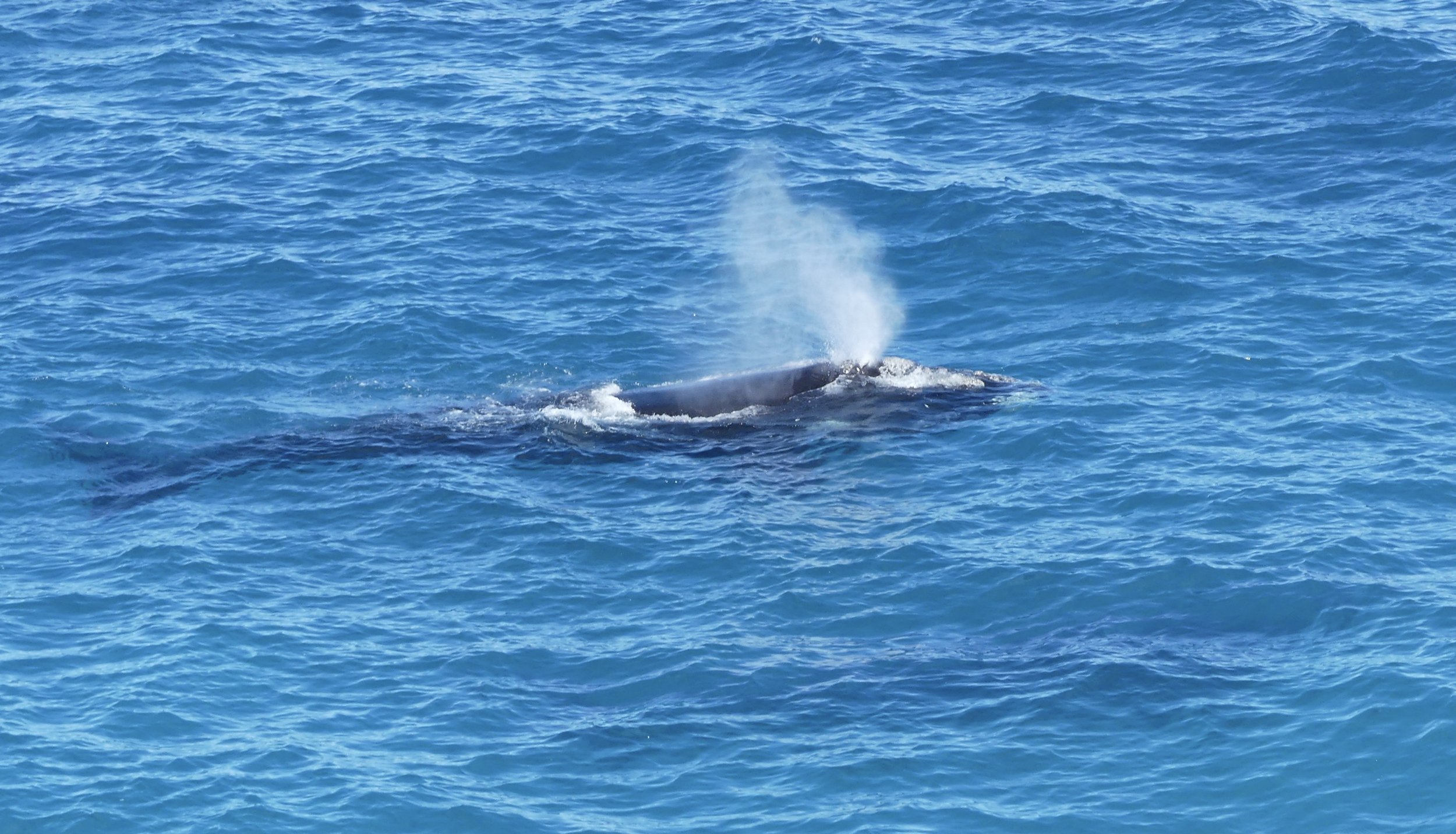
As luck would have it, we hit western South Australia a month into the Southern Right Whale breeding season (June to October). All vessels are prohibited from a Marine Mammal Protection Area at the Head of Bight from 1 May until 31 October. It was probably a bit too soon to see young’uns, but there were plenty of adults. They were easier to see than photograph, but I have never prioritised photos when there are whales about. It’s an overwhelming, emotional experience: I feel compelled to scan the water constantly and watch the whales ‘live’ rather than through a lens. You cannot afford to miss a moment while fiddling with focussing.

Head of Bight Lookout at Yalata SA


We got to Nullarbor Roadhouse just after 5: there were no allocated camp sites; there was no water, only power; we ate in the Roadhouse restaurant; there were noisy trucks constantly passing through.

Sunset on Day 17

Sunrise on Day 18
Nullarbor Roadhouse to Eucla 200 km
When we awoke it was five degrees outside and ten degrees inside The Van. Despite bright all-night campsite lights, the stars were brilliant up until sun-up. Only a desert sunrise photo could tempt me out of bed in such temperatures.
We didn’t need to rush. I made a sauce of our remaining peppers and onions so we wouldn’t have to bin them at the border. I gave away our last jar of honey to a family heading home to Victoria.
This day was a biggie for two reasons: spectacular cliffs and another state border. Pretty soon after we got on the road, the Eyre Highway returned to the coast and the fantastic Bunda Cliffs. In my diary I wrote that they were more impressive than the Cliffs of Moher in County Clare, Ireland, the previous benchmark. The Cliffs are essentially a limestone escarpment extending for more than 200 km with few breaks. Pounded relentlessly by the Southern Ocean’s high-energy waves, the Cliffs are slowly receding northwards.

Bunda Cliffs, looking west

Looking east
At the border we had to wait while some numpties in front of us emptied stuff out that they weren’t allowed to take into Western Australia.
Australia is a crazy place when it comes to the fruit police; and time zones. There was a smiley lady and an officious man at two checkpoints: it was the luck of the traffic flow who we’d get. The people in front of us got the friendly lady: we got the taciturn man who asked us several times if we’d got any honey, even after we explained we’d put it in the bin. He made a point of searching inside The Van, but not very thoroughly.
It’s easy to find out online which foods and products you are allowed to take across a border in Australia, or not. I recommend you check before reaching the border, rather than hastily reading signs once you’re approaching. Don’t chance it; don’t fight the system – which was always my inclination until I arrived in Australia one time having genuinely forgotten there was an apple in my backpack. And never assume common sense has prevailed, or will prevail, or that border officials will make exceptions or be lenient. The rules are usually associated with a particular insect that one state doesn’t want to acquire from its neighbour; such as a fruit fly. Respect the rules, co-operate with the border staff, and take their business seriously. You never know who’s got out of bed the wrong side that day, or who would prefer to be at home watching footie than asking you to do what you should have done already.
Then there was a wtf moment. There was a time zone we’d never even heard of, and we were in it! Central Western Time is three-quarters of an hour behind Adelaide (SA), which puts it out of kilter with Perth (WA), which is one and a half hours behind Adelaide. CWT doesn’t extend far north; it’s basically a strip either side of the Eyre Highway west of the SA/WA border for 340 km. Our watches automatically adjusted to Perth time as we crossed the border, however, so technically needed to be put forward 45 minutes, and then back again beyond the zone. Except we didn’t find about about Central Western Time until later, and wondered what the hell had happened to our gadgets. In truth, we didn’t know what time it was where we were for a while.
Read this for further clarification, or confusion, but it doesn’t address the question ‘why?’. Perhaps because South Australia uses Daylight Saving Time in summer, while Western Australia does not. Without this weird little time zone in between that does its own thing all year round, there’d be a two and a half-hour time change for those driving from SA into WA in summer.

Unhelpful clocks at Belladonia Roadhouse

Discontinued border post

Vegetation is primarily saltbush and bluebush