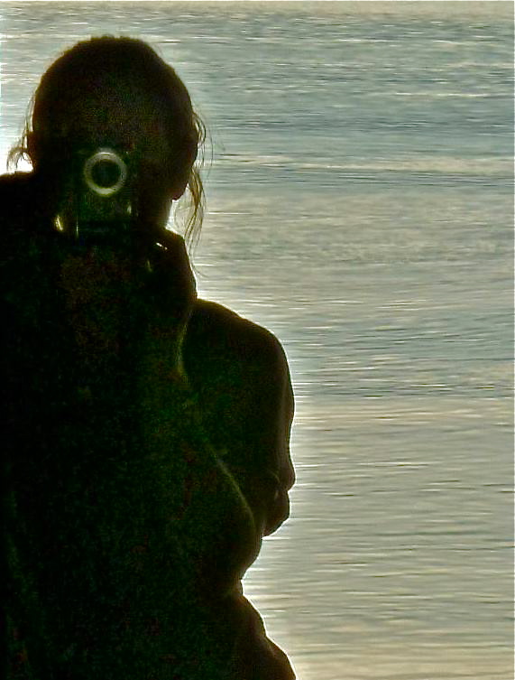

Brief encounters
South Australia’s Eyre Peninsula is a large triangular promontory jutting into the Southern Ocean between the Great Australian Bight to the west and Spencer Gulf in the east. It looks relatively small on a map of Australia, but both east and west coastlines are at least 320 km long.
The names of coastal features on the Peninsula tell a story: Anxious Bay; Mount Hope; Avoid Bay; Cape Catastrophe; Coffin Bay. Imagine ancient mariners coming to grief here, their vessels tossed by storms and swells in the Bight, then broken to bits on unforgiving rocks and headlands. You may be slightly disappointed, as was I, to learn that English navigator Matthew Flinders named Coffin Bay after a mate of his, Isaac Coffin, who was a naval commissioner in Sheerness dockyard where Flinders’ boat Investigator was fitted out in 1801.
That’s what expeditioners did then, name places after their superiors; sponsors or other benefactors; obscure administrators or minor nobility. I might have preferred Baie Delambre, an alternative suggested by French explorer Nicolas Baudin, who’d been tasked with the same challenge as Flinders at the beginning of the 19th century – to explore unknown stretches of the Australian continent. (Jean-Baptiste-Joseph Delambre was a celebrated French astronomer and mathematician.)
Flinders and Baudin were sailing the southern seas at the same time but in different directions, and came across each other by accident in 1802. Flinders later named the area Encounter Bay – roughly 100 km south of where Adelaide is today. He boarded Baudin’s ship and the two of them compared notes about their travels.
Our plan for the Eyre Peninsula was simple: down the east coast and up the west. By 1 July, we had driven 1,863 km from Torquay (VIC) in ten days. We left Port Augusta on the Lincoln Highway for Arno Bay, 235 km to the southwest. The campsite there was right by the sea, and we slept to the sound of gentle waves lapping rather than road trains thundering.

Arno Bay jetty

To the beach
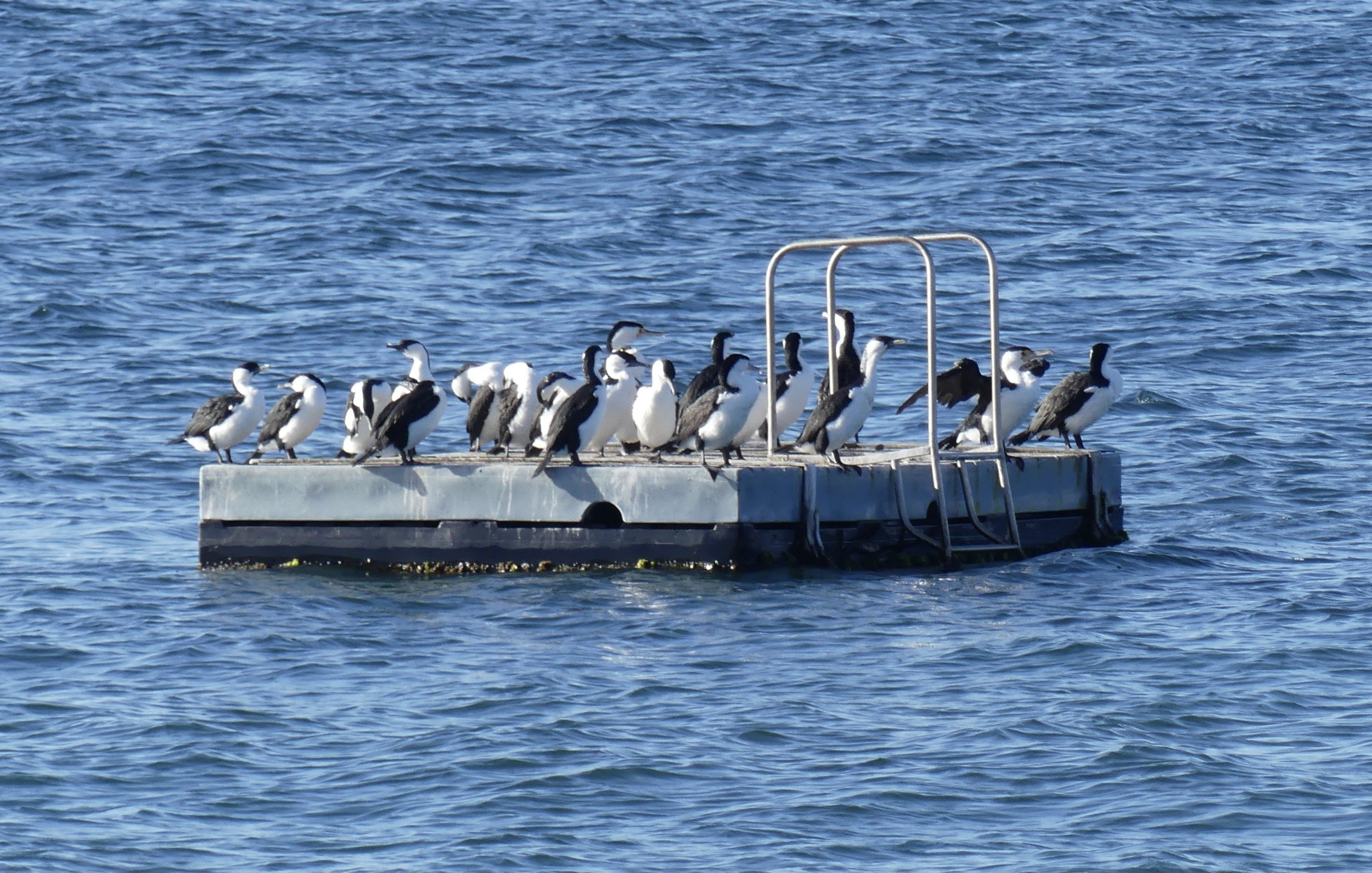
Mostly Black-faced Cormorants
Next morning we walked to the end of the jetty, where a cold lone fisherman reported there were fewer fish than the previous day; fewer fish generally. The fish find food nearby at the offshore commercial fishery growing Yellowtail Kingfish. When the pens are turned round, they dredge up seaweed which comes ashore on sandy Arno beach and Salt Creek’s samphire saltmarsh. We walked Arno Bay Mangrove Boardwalk, which was pleasant enough but almost spoiled by the shouty Dumbfeck family who let their dog and child roam freely through this sanctuary for shorebirds. Why did they think the boardwalk had been built?

I was suspicious of the distant low-lying white building middle right in the image above. What would need to be hidden away in a peaceful wild area such as this? The answer was revealed by a zoom lens on max from the end of the boardwalk. ⬇️

Clean Seas Tuna Research facility
On their website, Clean Seas Seafood Ltd profess to Sustainable Growth, Aquaculture Stewardship Council Certification, and being a Friend of the Sea. Always talk to locals for the full story. Since the Tasmanian salmon shocker*, I maintain a healthy cynicism about the claims of commercial fisheries. Waste products from pens are hardly likely to help preserve the mangrove and samphire ecosystems of the Arno Bay estuary for residents such as Red-capped Plovers and Pied Oystercatchers or visitors such as Sharp-tailed Sandpipers and Common Greenshanks.


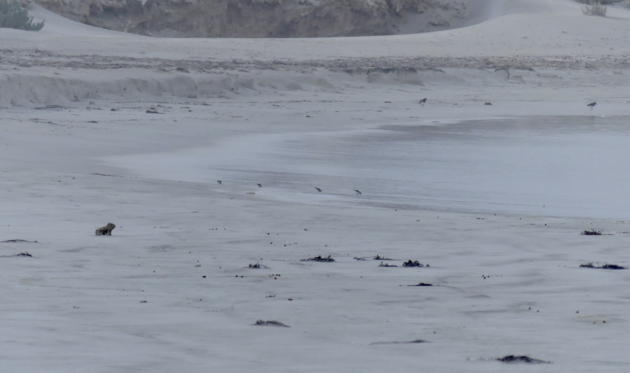
Pied Oystercatcher in Salt Creek seaweed
At the bottom of the Eyre Peninsula there’s a sticky-outy, smaller-scale peninsula on each side. South of Port Lincoln in the east is the Jessieu Peninsula, which has Lincoln National Park. We stopped in Port Lincoln for supplies, then dived into the National Park for a quick hike up Stamford Hill to the Flinders Monument. There were great views from the top, and hardly any people, but not much wildlife either.


On the way from east to west – Port Lincoln to Coffin Bay – there was Pillie Lake, which might have been pink-tinged had there been any water in it. In a groundwater-dependent ecosystem report produced for the South Australian Department of Environment and Water in 2020, Pillie Lake was classed as a ‘dampland’. This means groundwater remains close to the surface for much of the year, keeping the soil damp even though there’s no surface water.

Arno Bay to Coffin Bay 238 km.
Coffin Bay National Park was on our doorstep for two whole, glorious days. There was hard rain during the first night, followed by a blustery wind that whipped up the long waves, adding to the drama of this stunning coast. By day, there were sharp showers quickly followed by bright sunshine, and frequent rainbows. Into the National Park we went. Bit of a panic beforehand, however, when we couldn’t find a coffee shop my friend had earmarked.
First up was (anything but) Avoid Bay! It’s a wide sweep fronting up to the Southern Ocean. There is nothing between these waves and Antartica, a thought that filled me with awe.


Van’s been everywhere, man

Pacific Gull over Golden Island

Mates: juvenile Pacific Gull and Red-capped Plover on Almonta Beach
2 Oystercatchers, 4 Plovers and a driftwood ‘wombat’

So close to the end of the rainbow


Osprey
Ospreys are uncommon in South Australia: they’re more often found further south in the Bight west of Kangaroo Island. This one was heading back down there, I reckon. Numbers have fallen over decades as a result of entanglement with marine debris, environmental toxins, urban development and unregulated tourism. During the breeding season, if an osprey is disturbed from above by people peering over the cliff-edge, it will abandon the nest even if there are chicks in it.

Mount Dutton and the Marble Range from Templetonia Lookout

‘Which beach was it that…?'

On our final foray into Coffin Bay National Park, we turned right for Yangie Bay. In contrast to the west coast of the Peninsula, Yangie was calm and peaceful. Yangie Lookout Walk was short and sweet in warm sunshine. We almost walked past a resting roo without noticing.


From Yangie Bay Lookout

Grey Heron

Rock garden
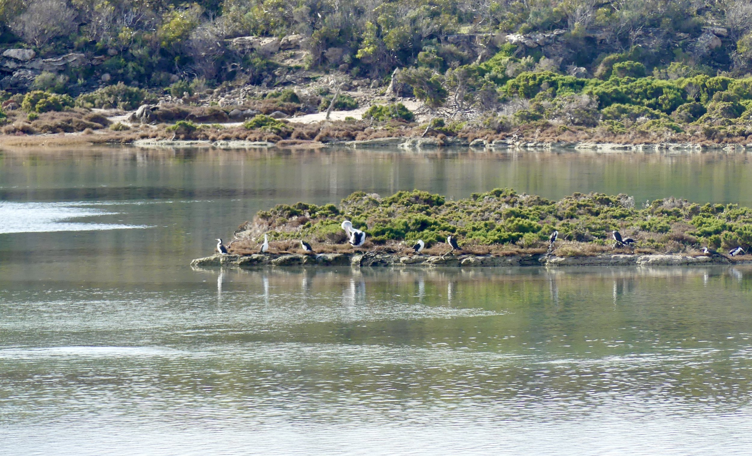
Yangie Bay is a Sanctuary Zone, one of eight within Thorny Passage Marine Park. A Sanctuary Zone provides a sheltered, relatively safe place – the Bay’s important seagrass beds – for marine species, especially juveniles.
Coffin Bay to Streaky Bay 321 km.
We were packed up and on the road before 9, stopping for breakfast in a quiet rest area. There wasn’t much traffic but there were roadwork delays. The landscape was less agricultural than in the east of the Peninsula, with many more trees.

Send-off from Coffin Bay Caravan Park

Heading north

Near Elliston was the 12-km Great Ocean Drive, reputed to rival Victoria’s Great Ocean Road. Er, I don’t think so. I didn’t like the colour of the cliffs here as much as other cliffs elsewhere. Looking at the relatively few pictures I took along the Drive, there were sturdy headlands, a strangely pale beach and another osprey, part of the biennial Sculpture on the Cliffs festival.

Fun with filters…


There were, however, some striking pink rocks at Cape Finnis. The pink comes from the haematite content of the Blue Range sandstone, my geology consultant tells me. Very colourful.

Long before Streaky Bay, our last destination on the Eyre Peninsula, there was a bit of a diesel drama. We hadn’t considered there might be fewer servos (petrol stations) beyond Coffin Bay: there weren’t any. The fuel indicator was so low, we reduced speed for the last 50-60 km; and agonised about whether we should make a 10-km detour to Murphy’s Haystacks – granite outcrops called inselbergs – rising monstrously from the plain. We chanced it, thank goodness, for they were weird and wonderful.


Was it snowing?

Lichen splodges
Streaky Bay was named by Matthew Flinders in 1802, who wrote in his log, ‘And the water was much discoloured in streaks… and I called it Streaky Bay’. This effect may have been created by reflection off oil released by seaweed in the Bay.
The diesel drama was superceded by the honey horror! By chance we learned in Streaky Bay’s tourist information office that we couldn’t take honey across the border into Western Australia. We were carrying several jars, because we liked a specific type of honey – Tasmanian leatherwood. There followed 24 hours of furious honey consumption to avoid confiscation of our stash. We spent some time in Streaky Bay post office sending a couple of jars ‘home’ to Torquay; and we gave some away; but still had to dump half a jar in the bins at the border. I think the official, who insisted on searching The Van, could probably smell honey because we’d been eating so much.
Streaky Bay has a splendid jetty. It’s long, and proved to be an excellent vantage point for spotting wildlife.


The best entertainment was provided by a chilled seal. The locals weren’t impressed, however. Imagine the cormorants’ thought bubbles: ‘Oh, here he comes again, Mr Show-off’. He was, of course, on the wrong side of the shark net.


There are a few other bays on the Eyre Peninsula: Dutton, Tumby, Boston, Jussieu, Sleaford, Venus, Baird, Searcy, Sceale, Peake, Louth, Fishery, Danville, Gascoigne, Smoky… and, to continue the theme of trial and tribulation, Misery. We didn’t visit these: we had to cross the Nullarbor.
* I was sure I’d already written about the disrepute of the Tasmanian salmon industry, but it would appear not. I will do in the story of our last remarkable visit to Tassie, at New Year 2021. In the meantime, read this.


