The Tasman Peninsula
Our previous experience of Tasmania's east coast was the beautiful Bay of Fires and the equally fabulous Freycinet Peninsula. Next up was the Tasman Peninsula with its promise of a dramatic but different coastline.
It was a warm sunny morning as we left Hobart – with no regrets. Once more we headed back towards the airport on the Tasman Highway and then on to Pitt Water and Orielton Lagoon – which together make up one of ten Ramsar wetland sites in Tasmania. With hindsight, we should have stopped to see if we could spot migratory shorebirds having a brief summer respite on the East Asian-Australasian Flyway. Two causeways allow you to drive across the water to and from Midway Point, before joining the Arthur Highway at Sorell.
Sorell was a busy little place, but there was markedly less traffic thereafter and some pretty countryside. In theory, it should take an hour and a half to drive from Hobart to Port Arthur (101 km), but we were often distracted.


Belties! You can't come to Tas without spotting striped cows (Belted Galloways)

At Dunalley, the Highway crosses an isthmus linking the Forestier and Tasman peninsulas to the rest of Tasmania. Dunalley Bay was stunning in the sunshine.

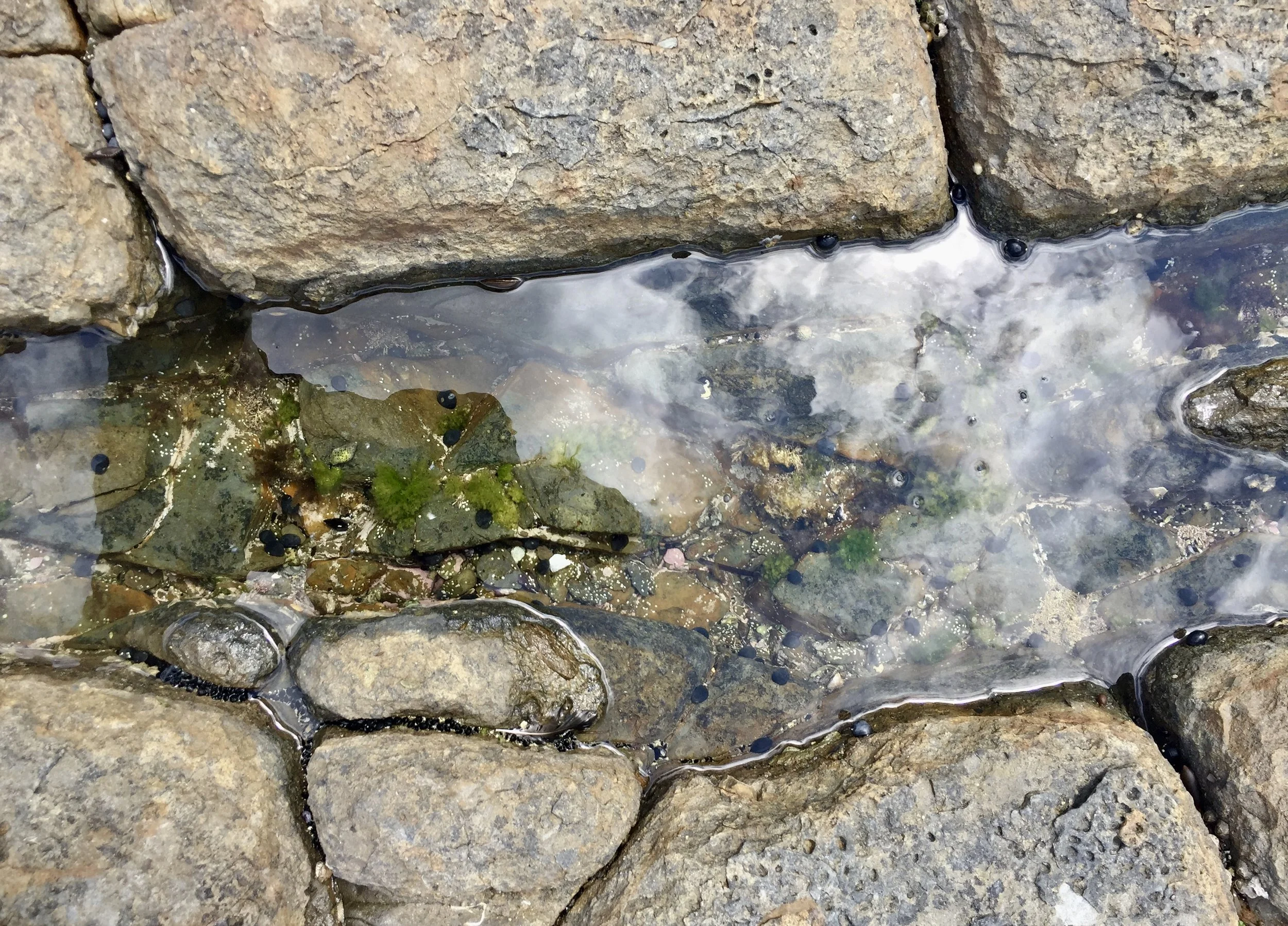
There's a must-see for geology fans in the southeast corner of the Forestier Peninsula – the Tessellated Pavement State Reserve – along a detour loop off the Highway.
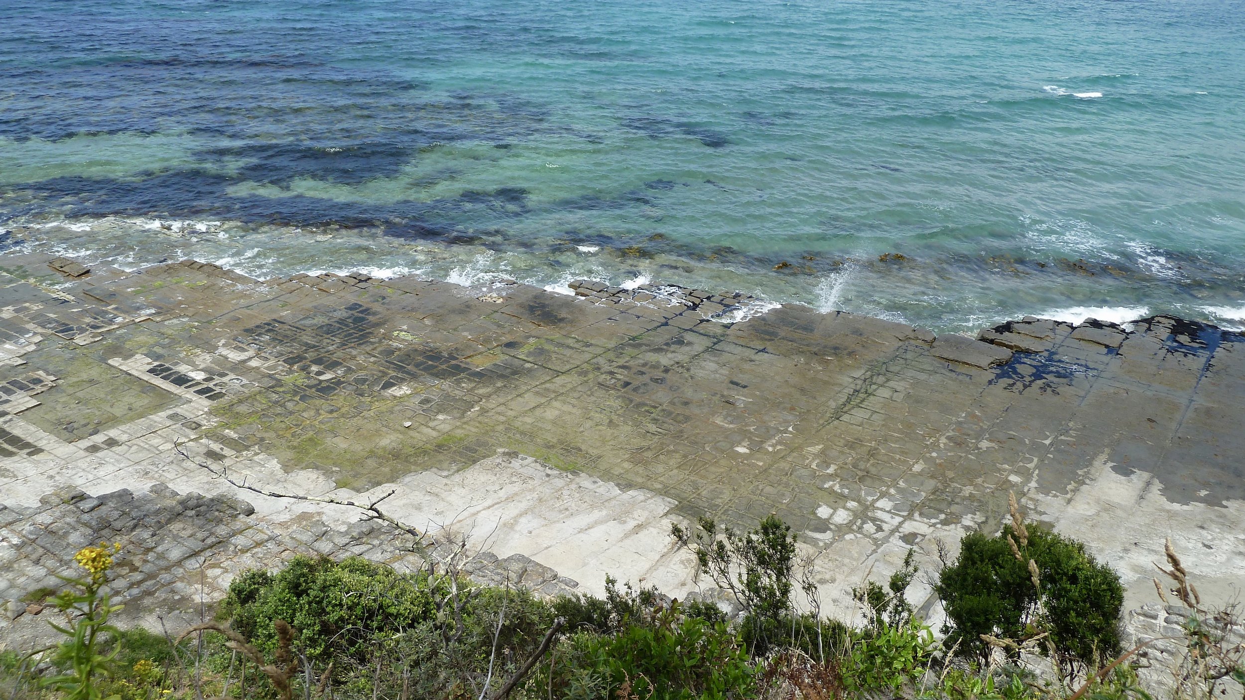
What has happened here is that rocks fractured by earth movements have since been eroded by the waves and sediments of the Tasman Sea. A naturally flat-lying area of siltstone – an inter-tidal rock platform – was cracked by stresses and strains within the earth's crust between 160 million years ago and 60 myo. The resultant cracks, or joints, have been enlarged by erosion, principally by sand and rock fragments carried to and fro by wave action. There has also been a chemical process at work: the crystallisation of salt from seawater as the rocks dry out. Over time, the crystals grow, causing small cracks in the rock and the flaking of the surface.
The pavement is extensive and the crevices intriguing.


There are other interesting features along this beautiful stretch of coastline, including Tasmans Arch, Devils Kitchen and the Tasman Blowhole. The next day we would see the most extraordinary cliffs and stacks.
But for now we continued on towards Port Arthur, across Eaglehawk Neck, an extremely narrow isthmus (only 30 metres at its narrowest point) connecting to the Tasman Peninsula. In the days of the Port Arthur penal colony, a dog-line – fierce dogs chained together – across this natural barrier deterred escapees from leaving the peninsula, unless they fancied their chances in the 'shark-infested waters' either side.
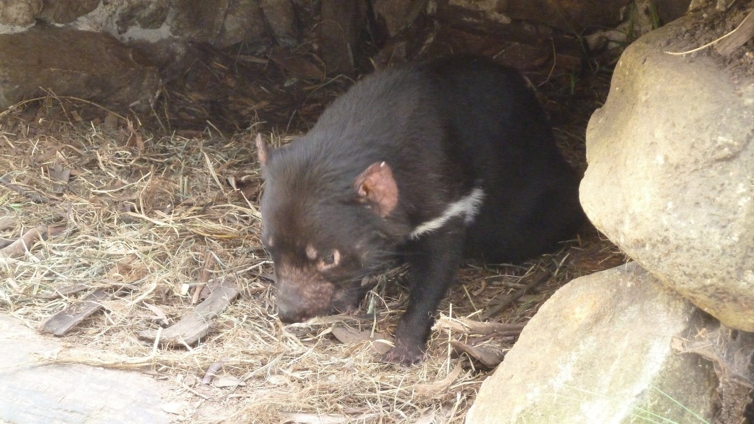
Not far down the road we came across the Tasmanian Devil Unzoo, at Taranna, about 10 km from Port Arthur.

The concept of an unzoo is described thus:
The Unzoo is a reversal of the traditional concept of a zoo. Instead of exhibiting animals in traditional enclosures for the benefit of humans, an Unzoo invites us into natural habitats in which cages or barriers are removed or concealed and wild, as well as resident animals, are encouraged to interact with the environment. An Unzoo creates an environment where animals have more dignity, freedom and self-determination, and where human visitors can experience personal, memorable encounters with wildlife and nature.
It was not far off feeding time, so we took photographs of resting Devils before the frenzy began, and took up our places for a chat by co-founder John. I was especially pleased to also get close to a Spotted Quoll, a first, even though it was on the wrong side of a fence.


John was asked about about the possibility of a Tasmanian Tiger ever being found on the island. He expressed his firm belief that the animal is not extinct, but hiding away – from trophy hunters most probably. On our way home a couple of days later I called back to get John's story.
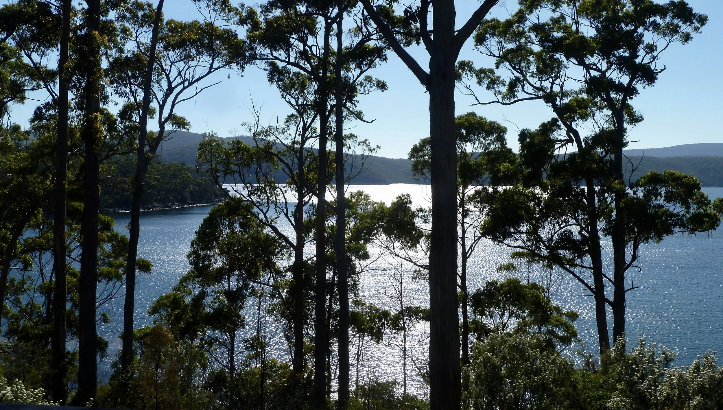
We stayed at Stewarts Bay Lodge in Port Arthur, in a spacious wooden cabin with a deck and the most restful, beautiful, watery view through trees. We often had the company of Dusky Woodswallows and Little Wattlebirds. I immediately regretted not having booked twice as many days.


We had one full day. Even though we had taken the Convict Trail Touring Route to get here, we were not inclined to spend that day in the Port Arthur Historic Site. You can find more information here if you wish to visit.
The convict settlement operated between 1833 and 1877, with the greatest number of inmates, more than 1100, during the 1840s. It was by all accounts a harsh, grim place, and many of those inmates condemned to the silence and solitary confinement of the notorious 'separate prison' block either did not survive at all or were mentally deranged by their ordeal. The Site was also the scene of Australia’s worst shooting massacre, in April 1996, and often described as one of the darkest days in the country's modern history. Thirty-five people were killed and 23 were wounded: the perpetrator is serving 35 life sentences in a Hobart prison.
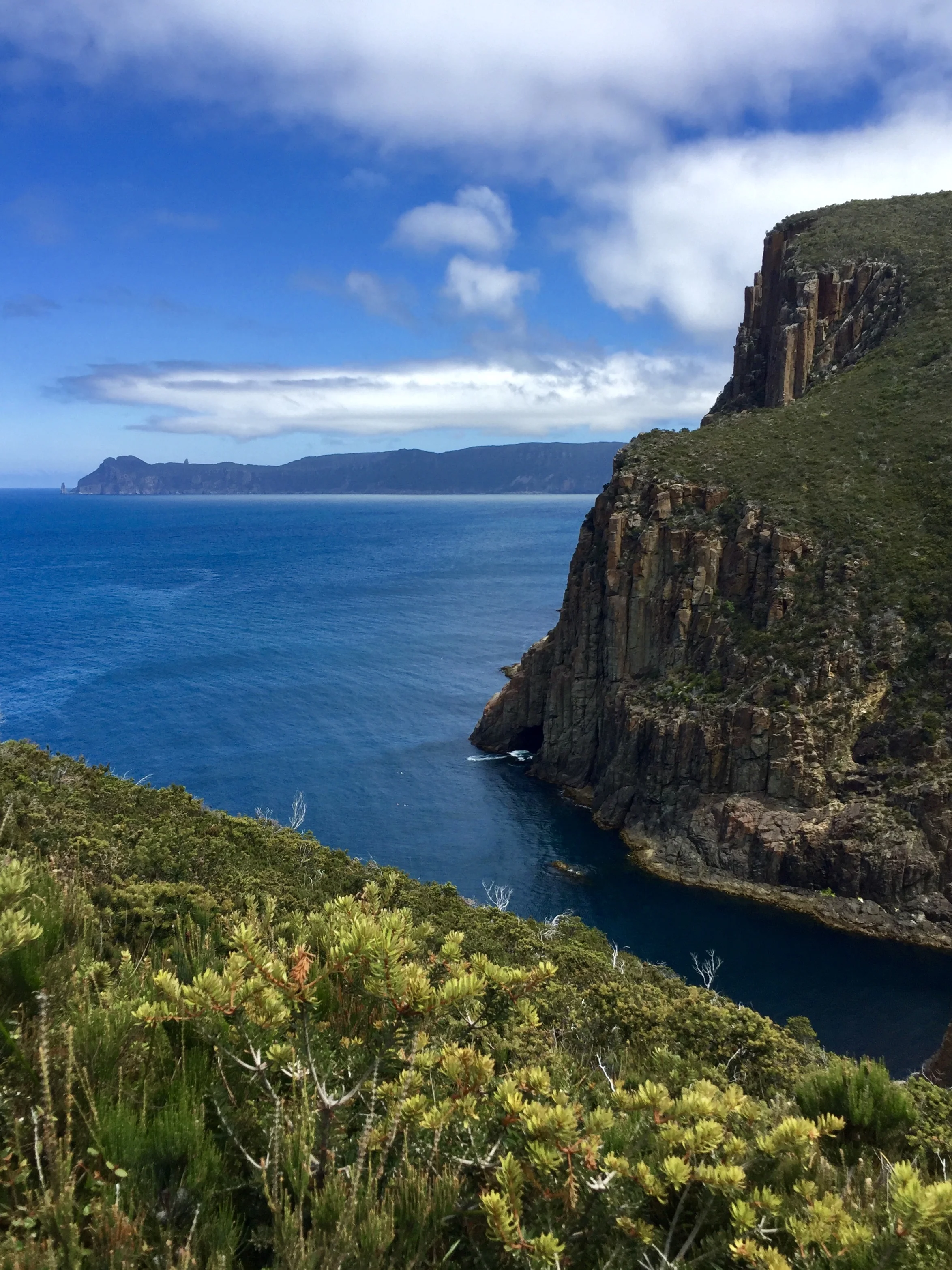
We preferred to spend our last day deep in the Tasmanian landscape, this time the spectacular coast around the southeastern tip of Australia. The Cape Hauy (pronounced Hoy) leg of the Three Capes Track seemed to fit the bill. Before heading to Cape Hauy, we decided to drive the circuit from Port Arthur to Nubeena, Premaydena and Koonya. As always, there were subjects of interest.


Parsons Bay from Nubeena
As we left Nubeena, my friend made an unscheduled turn – as is his wont – down a narrow road that soon became a dirt track. It was quite a way to Roaring Beach Bay but well worth the detour. The stunning beach was deserted apart from a few surfers, and by now the sun had come out, highlighting Outer North Head.


Roaring Beach Conservation Area

The road to Cape Hauy was not where we were expecting. Well, a road was still there, but it's name had changed. Someone or other must have decided that the occupants of holiday homes down the road should not be bothered by walkers on their way to the Tasman National Park. The signs to the Cape were now down a track further north, through a forest reserve. I hate it when roads on my map are disappeared in reality.
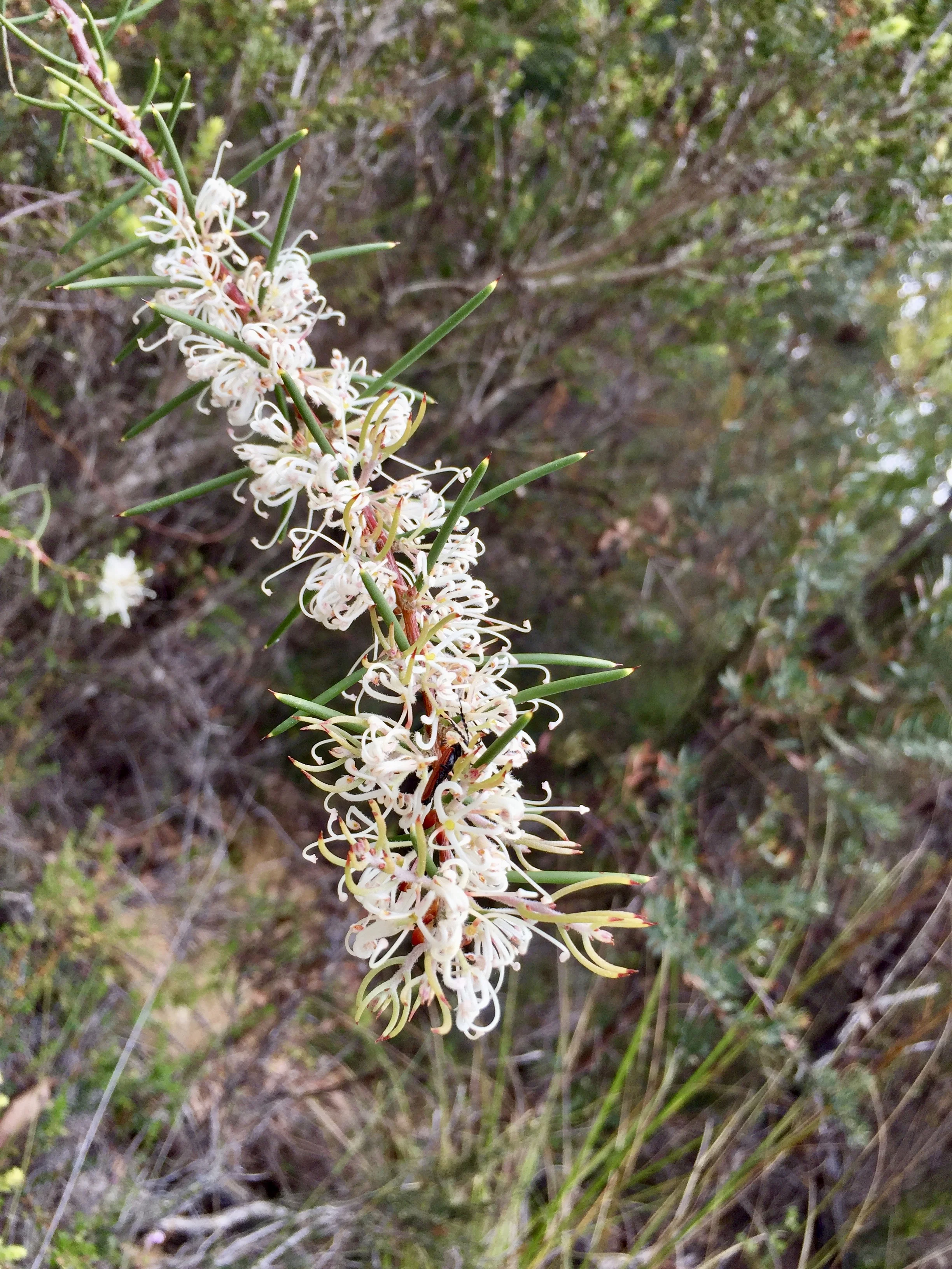
The walk to Cape Hauy from Fortescue Bay is 4.4 km each way, but a large proportion of that consists of well-constructed stone steps – some 4500 of them. When I look at the map on the Three Capes Track website, I realise what a pathetically small portion of it we did, but what an enjoyable four hours it was, drinking in this 'cliff-hugging wildness'. Don't miss it, if you're up for the thousands of steps. Familiar eucalypt forest and verdant heathland are backdropped by a seamless sky-and-seascape. The towering cliffs and dolerite pinnacles were stunning, but I'll let the photographs tell the story…


I believe this echidna is the Short-beaked variety, which is found all over Australia. It was browner than other echidnas we've seen. I love these creatures for the fact that they bury their faces so you can't see them. And this one had a particularly cute star-burst butt.


We ate that night at Port Arthur Lavender Farm cafe. Fading light wasn't going to stop me, however.


On our last evening, as we walked back to our cabin from Gabriel's on the Bay at Stewarts Bay Lodge, I took some photos in the almost-dark of what I hoped were wallabies. Nothing came out, except this. My imagination went wild.
Thanks for another five-star holiday, Tasmania.