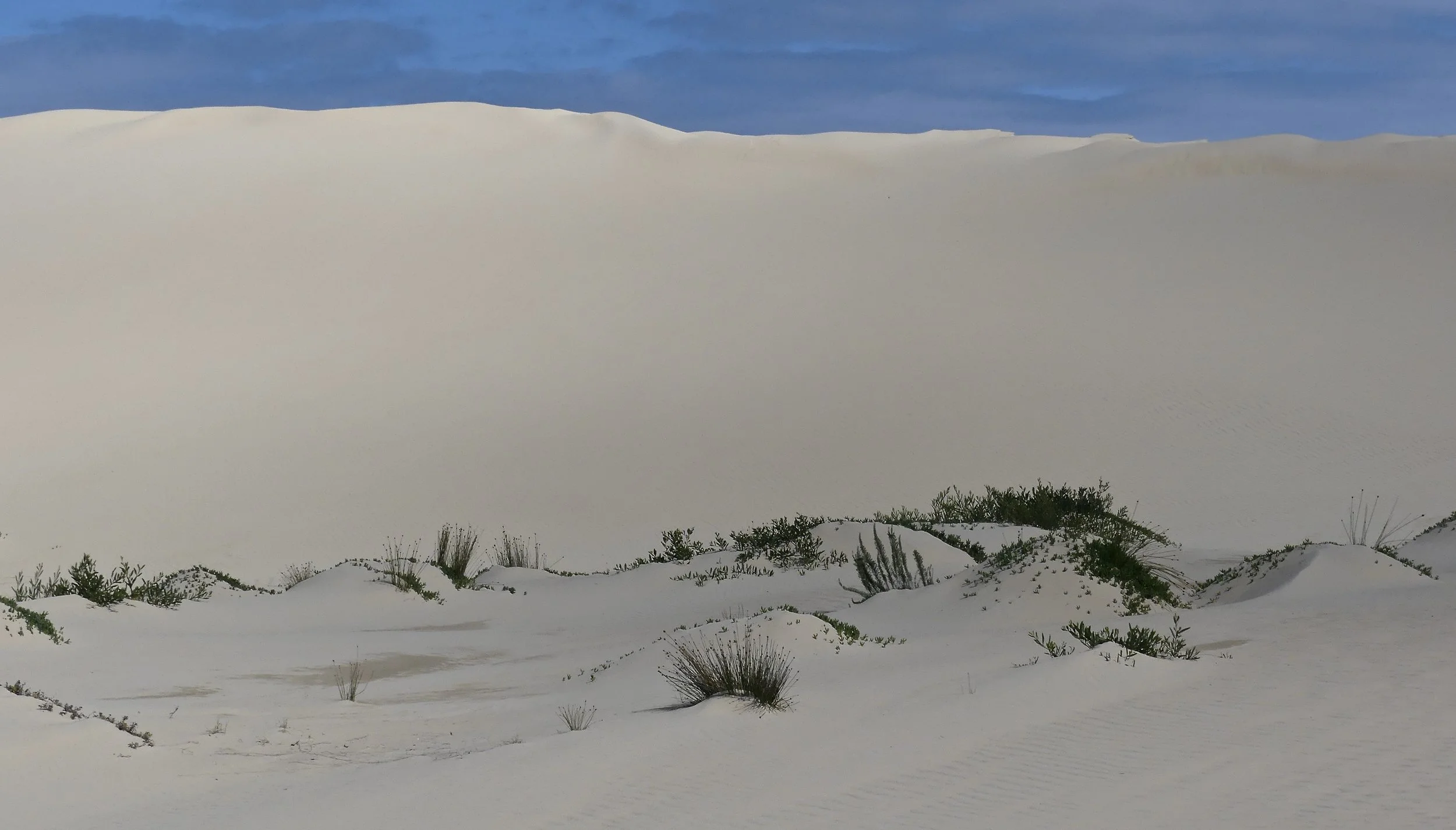
Big Drift
It's hard to beat sand dunes large enough to imagine being in a desert, with a warm sun beating down from a bright cloudless sky. Big Drift on the Yanakie Isthmus of Wilsons Prom is magnificent. We easily spent a couple of hours there.
How do the dunes come to be where they are? The consensus is that their southwest orientation is consistent with prevailing onshore winds.
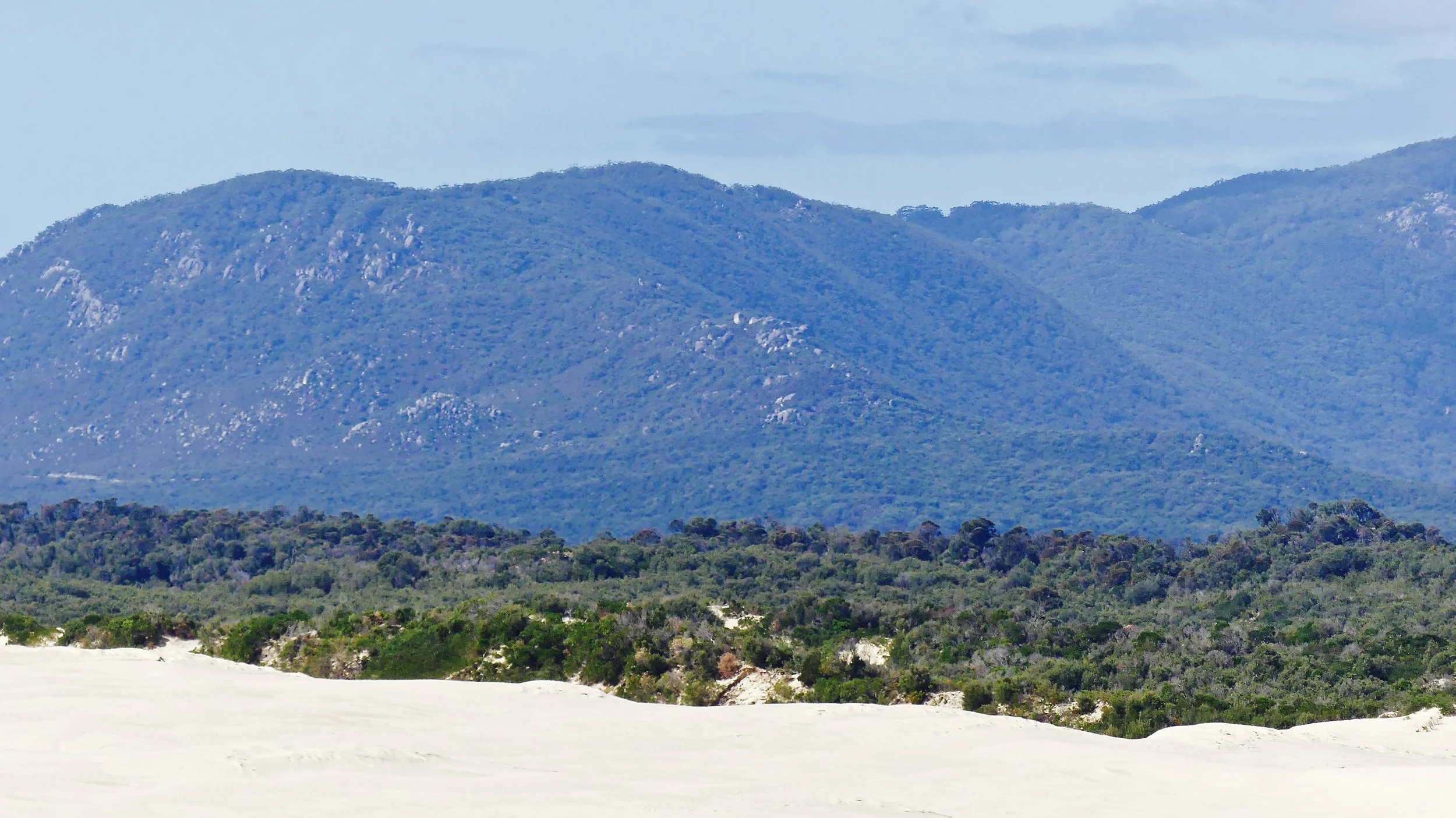
Dunes and sand plains cover much of the coastal plains south of Victoria's Southern Uplands. The sands are of two types: calcareous and siliceous. Calcareous describes sand with a significant calcium content, in this case from degraded shells originally on the sea floor of the Bass Strait. Siliceous sand consists mainly of quartz weathered from granite or other basement rock types. Sea sea levels were once higher, and what are now The Prom's mountain-tops formed a group of islands. As sea levels subsequently fell, sediments were exposed and transported by wind.
Wilsons Prom marks a boundary in the composition of sands along the Victorian coast. Calcareous sands are found to the west of the peninsula, and siliceous to the east. The Yanakie dunes, stretching across the Yanakie Isthmus, are essentially unstable, parabolic calcareous dunes. As they drift east, they feed the beaches on Corner Inlet.
Looking to Yanakie Isthmus from Vereker Outlook
To get to Big Drift, make a U-turn immediately after Wilsons Promontory National Park entrance, and take a left at the sign to The Stockyards. There's a camping area and a car park, beyond which is the start of the walk. Go through the woods until the first left turn, down to a clearing. Turn right and, at the bottom by the fence, follow Hellisons Track as far as the left-hand fork on to The Drift Track. You have to climb steeply up the northern flank of the dunes. It's a case of two steps up and one step back; a good workout for the calves.
I have a word of advice that will seem unnecessarily cautious. Once you're at the top, take stock of your position. I didn't believe the warning sign about getting lost, but after a couple of hours' wandering, when you head back to where you think you came up, it may not be quite where you thought it was.
Wind sculpts all sorts of patterns and shapes in the sandscape.
Whose profile do you see?
A giant's footprint
At one point, a few clouds drifted over, creating pleasing light and shade across the sand surface.
A dune is much more than a pile of sand, of course.
Un bicho
We observed Pipits flitting, and a gang of four Yellow-tailed Black-Cockatoos on a mission.

It's difficult to know whether the sand is swallowing the vegetation or the scrub is consuming the sand.
There is no access to the beach from the dunes. So return to Promontory Road and head south as far as the right turn for Cotters Beach, the next turning after Five Mile Road. You have to park and walk across the dry bed of Cotters Lake to reach the Beach. It was quite hot walking across the lake bed. There was a report of a snake further along the path. We looked hard, but no luck: haven't seen a Victorian snake yet.
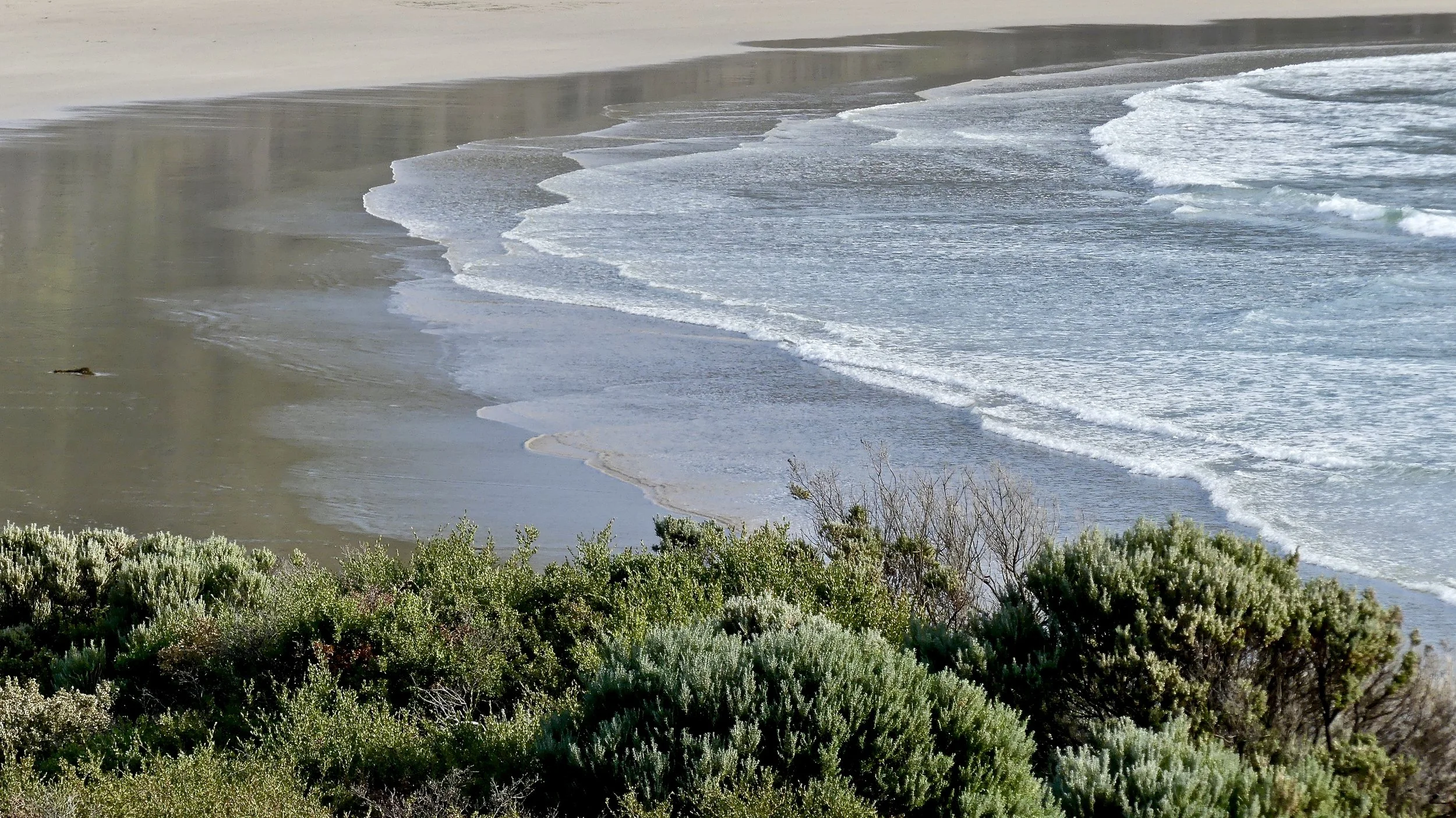
Looking south
Looking north
Pacific Gulls are whoppers. Crows are not small, but this one knew his place and waited respectfully for any leftovers. I also saw waders that were difficult to identify, being largely in profile. They might have been Sandpipers. It was an endless beach.
Pacific Gull dancing
Sandpipers?