Bells rock
The next stage of the Big Trip was Esperance to Albany, some 500 kilometres via Ravensthorpe and Jerramungup. There were two important detours off route, however; one to Hopetoun and another to Bremer Bay, either side of the Fitzgerald River National Park.
I’d never heard of the Fitzgerald River National Park before we were almost there. I must either have heard fellow travellers mention it, or it cropped up as I researched places as we went along. In any case, I decided we should take a look. My diary records: ‘I wouldn’t have missed this for the world: feels remote, few people, stunning beaches and big views. And the plants! …some of them like extra-terrestrials.’
But first, Ravensthorpe, where nearby mines produced sudden random bangs that shook the town. No one batted an eyelid, except perhaps the occasional jumpy newcomer. Miners flood into town at certain times of day. The Palace Hotel Motel looked pretty closed by day, to the extent that we called to make sure they were serving evening meals. Later the place was rammed: the Palace had a contract to feed the miners.
We asked if we could share a small table: the man sitting alone turned out to be the same one who’d knocked on our door back in Madura to ask what we thought of The Van. Now we chatted as if we’d met an old friend in the pub. I ate excellent battered Red Emperor with salad and fries, and wondered if the mining revenue had resulted in the higher-than-usual standard of pub food.
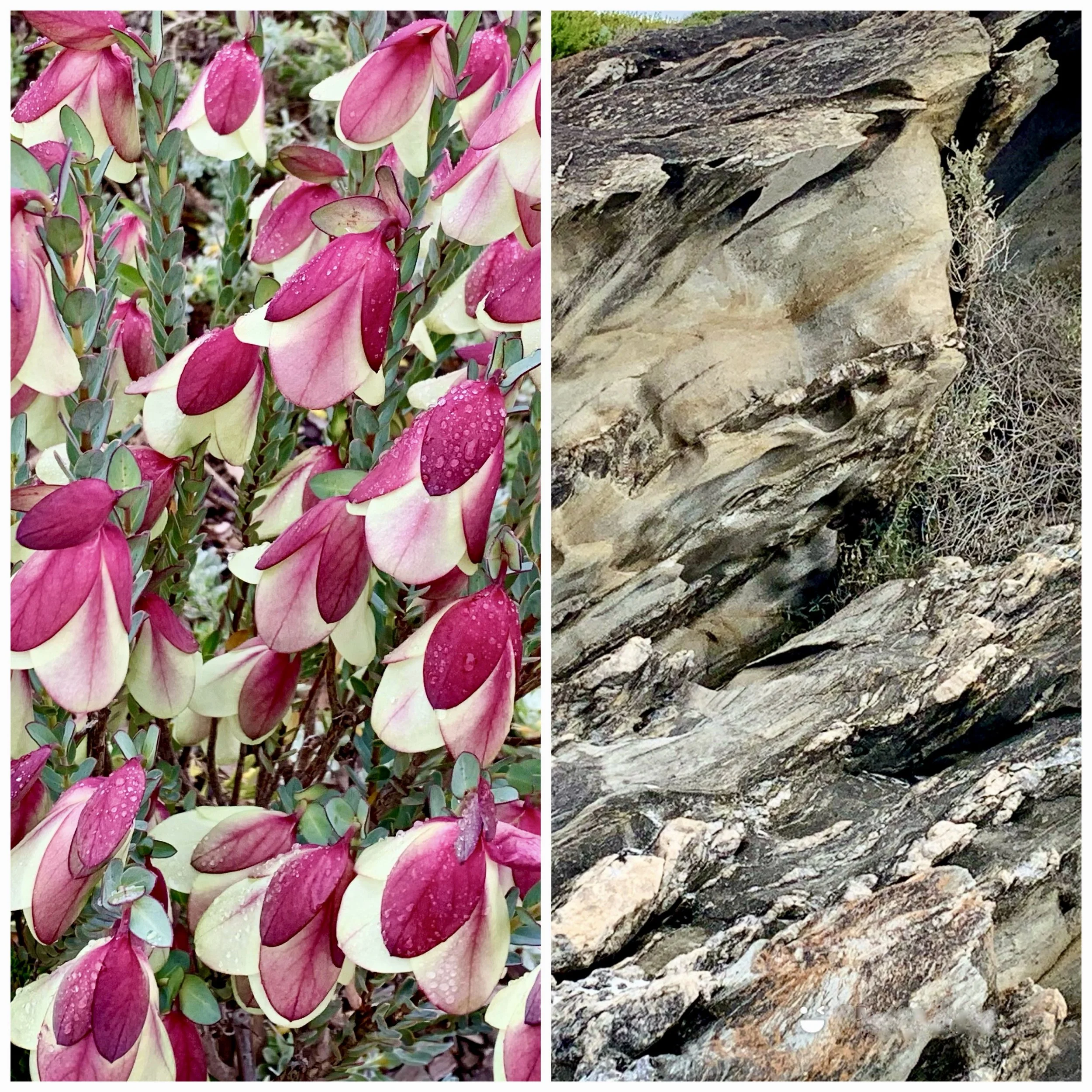
Earlier in the day we’d walked around town in cold, heavy-grey weather, as far as some silo art – the stages of growth of a banksia, a great subject and ideally suited to the graphic design. Chatting workmen spoilt the photographic potential on one side of the silos with their utes and crane. There was a new cafe adjoining Foodland, whose shelves were more than half-empty. We had coffee and toast but ate quickly because it was so cold in there. In the tourist information office we learned about the region’s extraordinary plant life – sophisticated Qualup Bells (top of page) and primordial Hakea victoria, weirder than strange but at the same time tall and imposing (see further down).

The tiny marsupial Honey Possum is found only in the southwest of Western Australia. Its teeny-tiny joey stays in the mother’s pouch for about nine weeks after birth; and four to six babes only are raised each year. This is not many compared with other small mammals, but enough to have sustained the Honey Possum population for thousands of years.
We debated at this point whether to make a dash north in search of brighter skies. We left Victoria in mid-winter, but I never imagined the weather in WA would be as bad. The shall-we-shan’t-we element of decision-making was stressful, especially in the knowledge that it was 30+ degrees in the north of the state while where we were was wind and rain on repeat. We decided, however, to stick with the plan.


Silo detail: Honey Possum


Ravensthorpe to Hopetoun was a whisker short of 50 km, so not far enough for the weather to change, but Hopetoun lived up to its name.

Blue sliver of hope beyond the foreshore
To the east of Hopetoun the Southern Ocean Road is sealed as far as Twelve Mile Beach but continues to Starvation Bay and beyond to Esperance Nyungar country. We went west, into the eastern Fitzgerald River National Park.


Culham Inlet from East Mount Barren walk


Barrens regelia (Myrtle family)

Looking west from East Mt Barren


Hakea the magnificent
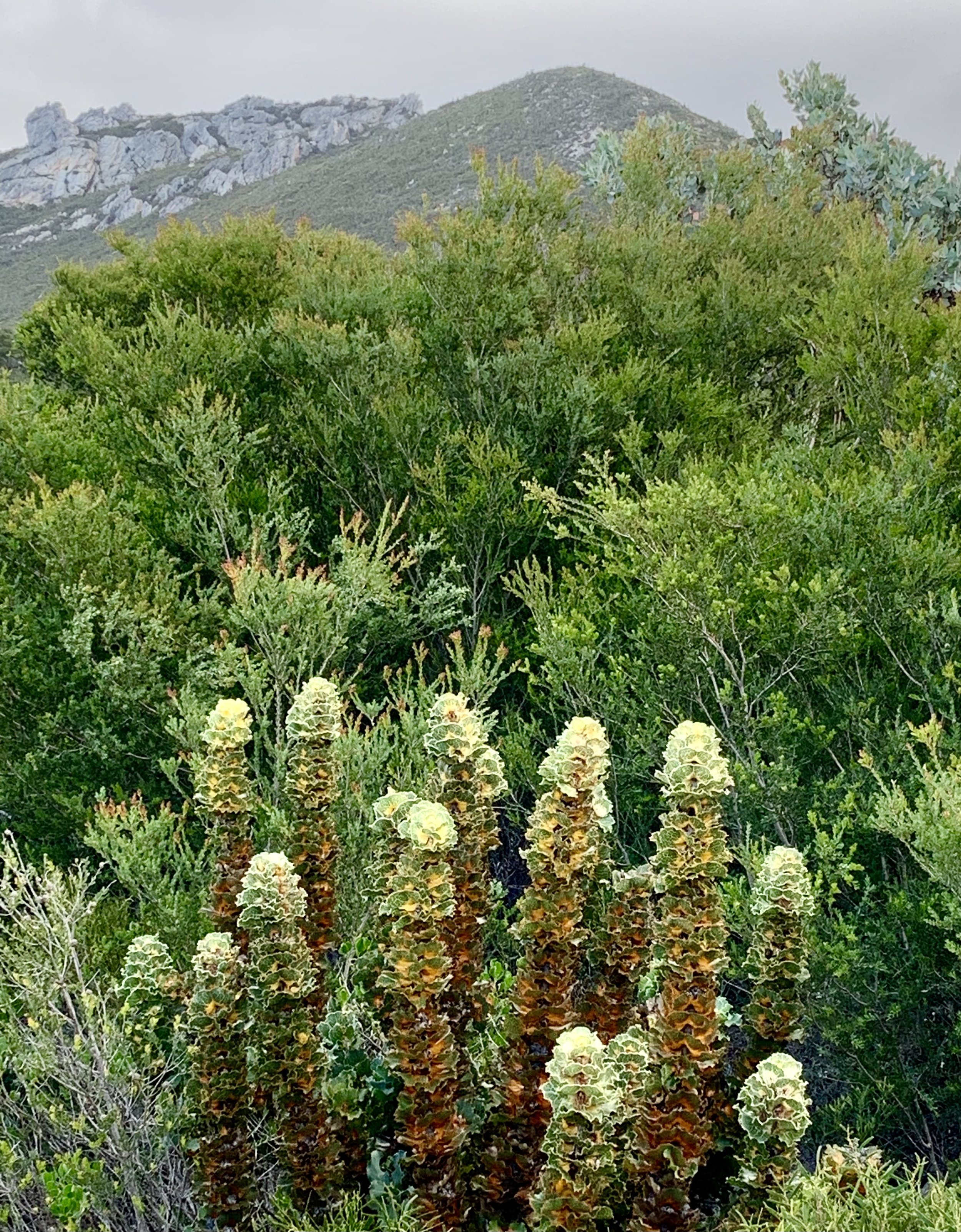
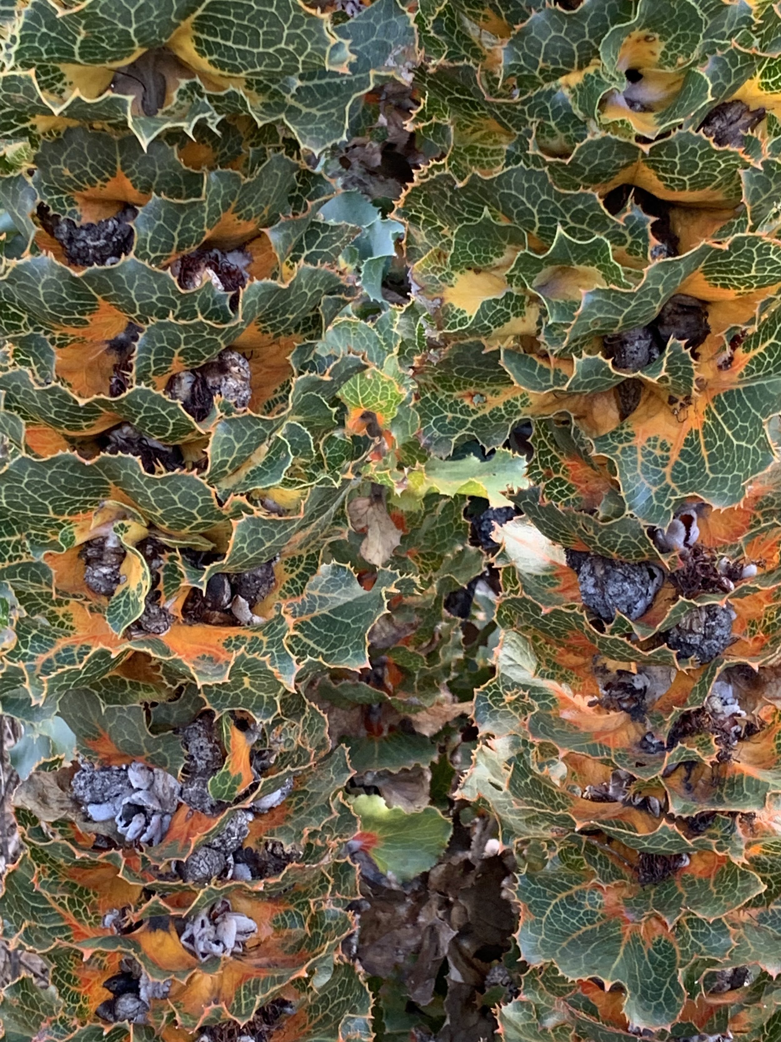
Hakeas grow to at least two metres tall, and are unique to the Fitzgerald River National Park between Hopetoun and Bremer Bay. Not surprisingly, these plants are of special significance to the Nyungar people, who believe them to be ‘ochre warriors’ keeping watch over country to ensure spiritual respect. There are few walking tracks let alone roads in the Park: I pictured legions of Hakea across the remoteness but seen by few. They were first brought to the notice of the world by botanist James Drummond, near the Barren Ranges at Hopetoun, in 1846.
Progress was slow getting into the wilderness beyond Culham Inlet. I wish, however, I’d paid more attention to the Inlet. A lagoon is fed by two rivers – the Phillips and the Steere – and flow has increased in recent times as a result of substantial land-clearing for pastoral settlement north of the Inlet. Floodwaters in 2017 destroyed parts of a one-kilometre-long embankment separating the lagoon from the sea: it has since been rebuilt with concrete culverts that release excess water from the lagoon when necessary, ensuring access to the National Park by road.

Birds love the Inlet: 48 species of bush birds use the fringing vegetation and 52 species of shorebirds are found in the Inlet, including 12 migratory species such as the Common Greenshank. A Greenshank leg-banded in 2003-06 was shown to have flown half-way across the planet, from here to Chongming Dao in China, at least six times, some 60,000 km. Less common birds include Carnaby’s Black-Cockatoo and the Cape Barren Goose.

Carnaby’s or Short-billed Black-Cockatoo
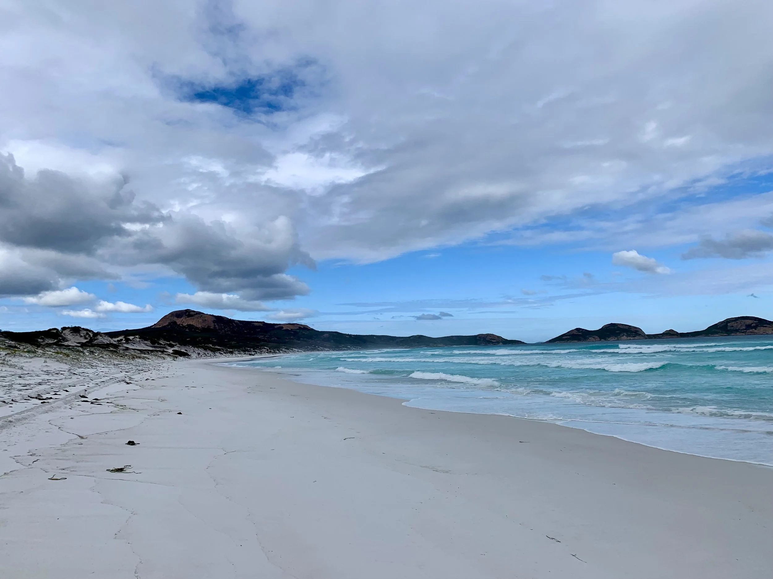
We drove west from Hopetoun as far as Hamersley Inlet, where there’s a sheltered lagoon with a short timber walkway connecting it to a beach that had raging surf; which was quite a contrast.
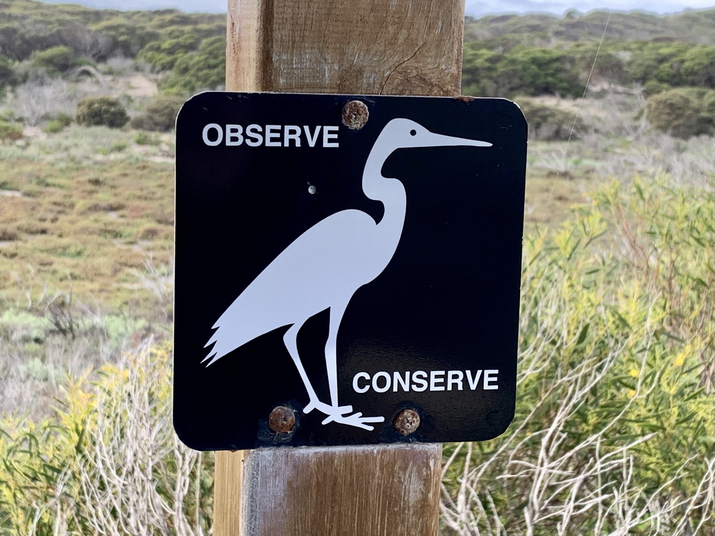
A sign designed to make you think

Australian Shelduck


Scarlet Banksia

Red Toothbrush Grevillea
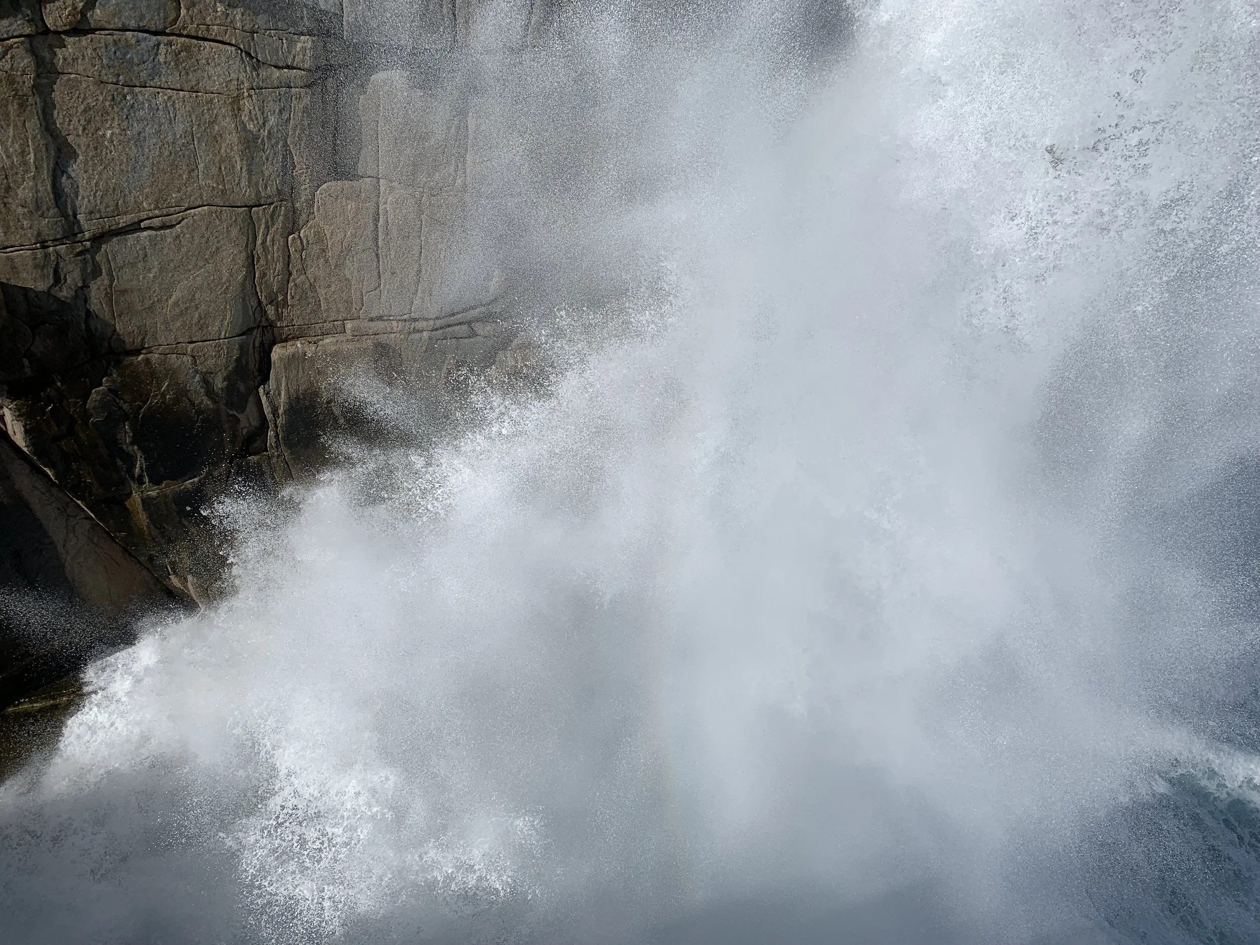
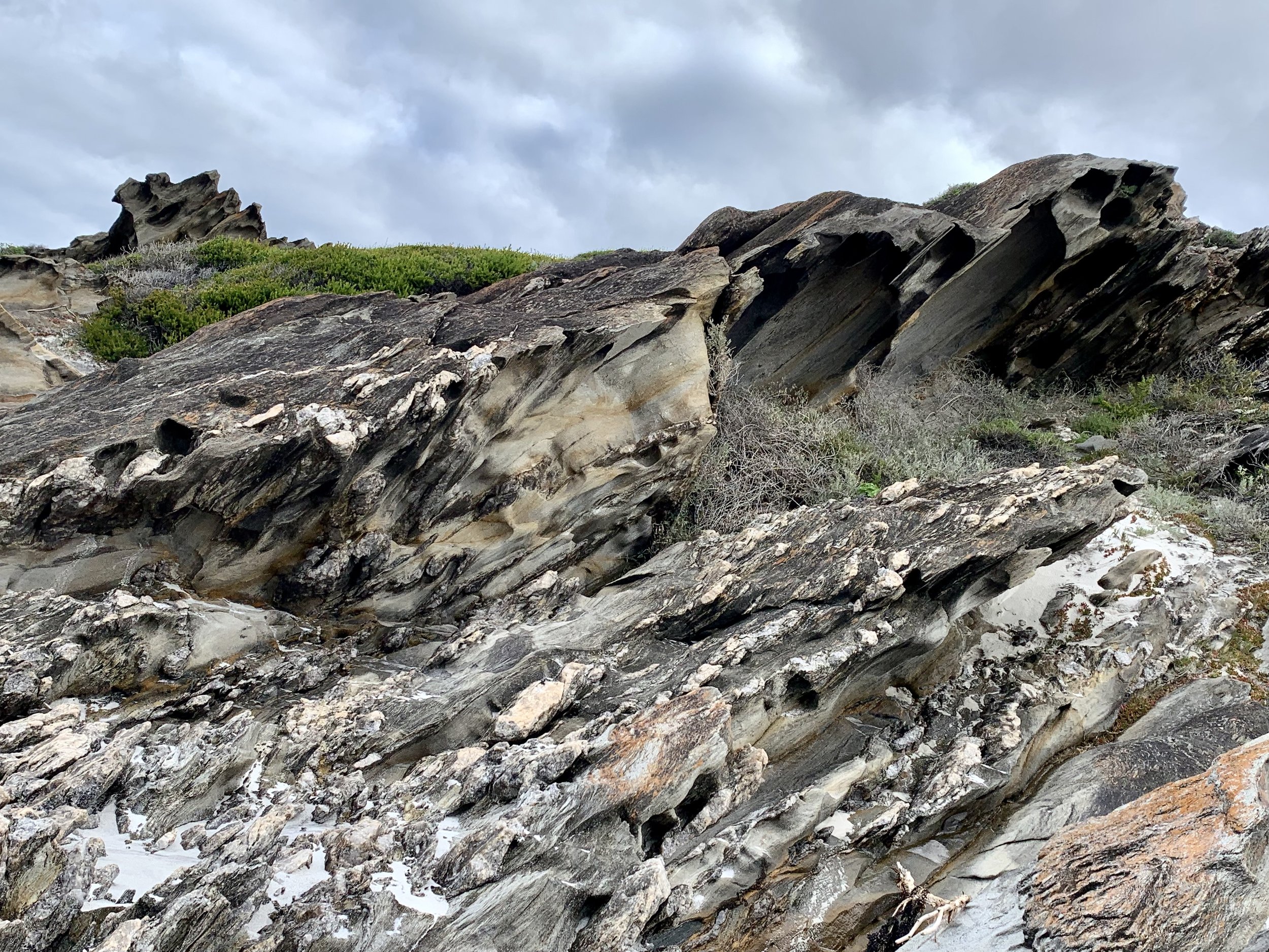
At West Beach there were great rocks; fantastic rocks, in fact, and I’m not even the geology enthusiast in the party! They were pelitic schists, which are metamorphic rocks.

Painting or photograph?


It was a fine morning when we left Hopetoun, but the wind soon got up: gusty crosswinds made driving a high-sided vehicle a lot trickier. There was virtually no traffic once we left Highway 1, but there was a lot of standing water along the roadside. Bremer Bay felt deserted.
Bremer Bay’s green and pleasant campsite
Next day, we tried to get breakfast at the Wellstead Musuem, a beautiful stone building, but it was closed for annual holidays: the tourist office had said they’d be open. So we tried The Telegraph – in the old telegraph station obvs – and another lovely stone building. It was freezing in there but they had great homemade granola. Then we went to walk across the mouth of the Wellstead estuary on a sand bar, but the water was too deep as a result of an exceptionally high tide. Lots of 4x4s were turning up, expecting to be able to drive across, but there was no way.
We decided to visit the beaches of Point Henry peninsula. Some roads on the map had been disappeared in reality to reduce access to an ‘abalone operation’; and a lot of the peninsula was marked out into plots for a housing estate, both of which were a bit depressing.

Surf’s up at Native Dog Beach

At the Bremer Beach Resort that evening I enjoyed chicken and mushroom pie with veggies; my friend had lamb korma, but not as we know it.
Next day we were moving on. I wasn’t sorry. Sometimes, for not necessarily obvious reasons, you just want to be on your way. I’d had a rather fanciful thought that we might be able to drive to Point Ann, on a much less accessible part of the coastline of Doubtful Islands Bay. But there wasn’t time; and probably never had been. We’d spoken to the Parks Office in Albany, who’d said tracks that were closed in western parts of the Fitzgerald River National Park might be re-opened if there’d been no rain in the previous couple of days. But there was no confirmation on their website of Point Ann Road being open again. It was all too vague and chancey; and you’ve got to know when to call off a wild goose chase.