The Tarkine and the battle for our forests
'Tis the season of prescribed burns in Victoria. Smoke haze gets daily mentions on ABC Radio Melbourne weather forecasts. And today I can smell it for the first time in the stillness, which is a joy after incessant wind weeks ago.
Controlled burns are part of the management of bushfire fuel – leaf and bark litter plus ground and mid-storey shrubs and small trees – which also includes slashing (a very Australian word), mowing and the creation of fuel breaks. Forest Fire Management Victoria involves the Department of Environment, Land, Water and Planning; Parks Victoria; Vic Forests; and Melbourne Water. Anyone can go online and find out if there's going to be a burn near them. Quiet autumn days are ideal for fuel reduction burns, and the ground is at its driest. March and April have been exceptionally dry.
An ecological burn is a means of controlling the spread of invasive species, or triggering the growth of species that depend on fire for germination and flowering.
Then there are logging*, or post-logging, burns which follow clear-felling and are intended to encourage regrowth. I would be more enthusiastic about this if I believed lifeless serried plantations had any merits other than profits for loggers.
There's a Fuel Reduction Programme in Tassie, too. There, you can check What's Burning Now? online. I don't like that title, probably in no small part because of my deep mistrust of the rebranded Sustainable Timber Tasmania (Forestry Tasmania), one of several key stakeholders involved in decision making with the Tasmania Fire Service.
Twitter has been full of photos of huge smoke clouds and fears for threatened species whose habitat is going up in flames.


The Mountain Ash forests of Victoria's Central Highlands are less than an-hour-and-a-half's drive east of Melbourne. The region provides most of the city's water and is home to the world's tallest flowering trees. Over years and years of logging and burning the Mountain Ash forest has been reduced to one per cent of its original range, and is declared critically endangered by the IUCN (International Union for Conservation of Nature). Ash forests provide a home for many creatures, including the state emblem of Victoria, Leadbeater's Possum, now also critically endangered.
There is a move to create a Great Forest National Park – and yes, it is surprising there isn't one already. Many areas of forest would be protected under this scheme, but there would inevitably be a price to pay. High-quality tourism would be an important feature, and ambitious plans for the new Park include camping, skiing, trail biking, four-wheel-driving, hunting and zip-lining, most if not all of which diminish the natural world.
Meanwhile, back in Tasmania, the Tarkine (named after the Tarkayna people of the region) has been a forest battlefield as long as I have known anything about the island state. It can surely be added to the list of notorious environmental campaigns, from Lake Pedder and the Franklin River, also in the Tasmanian Wilderness, to James Price Point in the Kimberley, Bentley in the Northern Rivers (NSW) and Stop Adani in Queensland's Galilee Basin. Those who had long striven to protect the Tarkine from miners and loggers breathed a sigh of relief in 2013 with the passing of the Tasmanian Forest Agreement which saw an additional half a million hectares protected in national parks and reserves. A few months later, 170,000 hectares of that was added by the World Heritage Committee to the existing Tasmanian Wilderness Heritage Area.
Early the following year, the prime minister I soon renamed Idiotabbott – which was mild under the circumstances – tried to de-list 74,000 of the 170,000 on the grounds that the land was logged and degraded. Some of the forest was regrowth, certainly, but I suspected an ulterior motive, such as access to rich mineral deposits. In any case, UNESCO rejected the application and Australia looked pretty daft in the eyes of the world.
Unbelievably, another right-winger, William Hodgman, recently re-elected as Tasmanian premier for a second term, is, according to Bob Brown, intending to change the wilderness status of a number of sites for the benefit of rich mates wanting to get richer under the guise of 'ecotourism'. First in his sights are Lake Malbena in the Walls of Jerusalem National Park and Frenchmans Cap in the Tasmanian Wilderness World Heritage Area. Development will take the form of a few luxury 'eco'-lodges in remote areas accessed by helicopter and complete with zip lines for super-rich kids and powerboats so their parents don't have to mix with riff-raff on river cruises.
What hope is there for Port Davey, Melaleuca, Recherche Bay, Mount Reid, Dove Lake, the Adamsfield track or Strahan?


Allegedly, Hodgman would take the 'Wilderness' out of TWWHA if he could get away with it.
When our first Tasmanian tour touched the remote west coast, we had neither the time nor the right car for what I'm fairly sure was then an unsealed road south of Arthur River township. Now you can drive south with relative ease along this wild and rugged coastline as part of The Tarkine Drive. Again we were limited during a long weekend in February to a day's circuit from Smithton, around the C218.
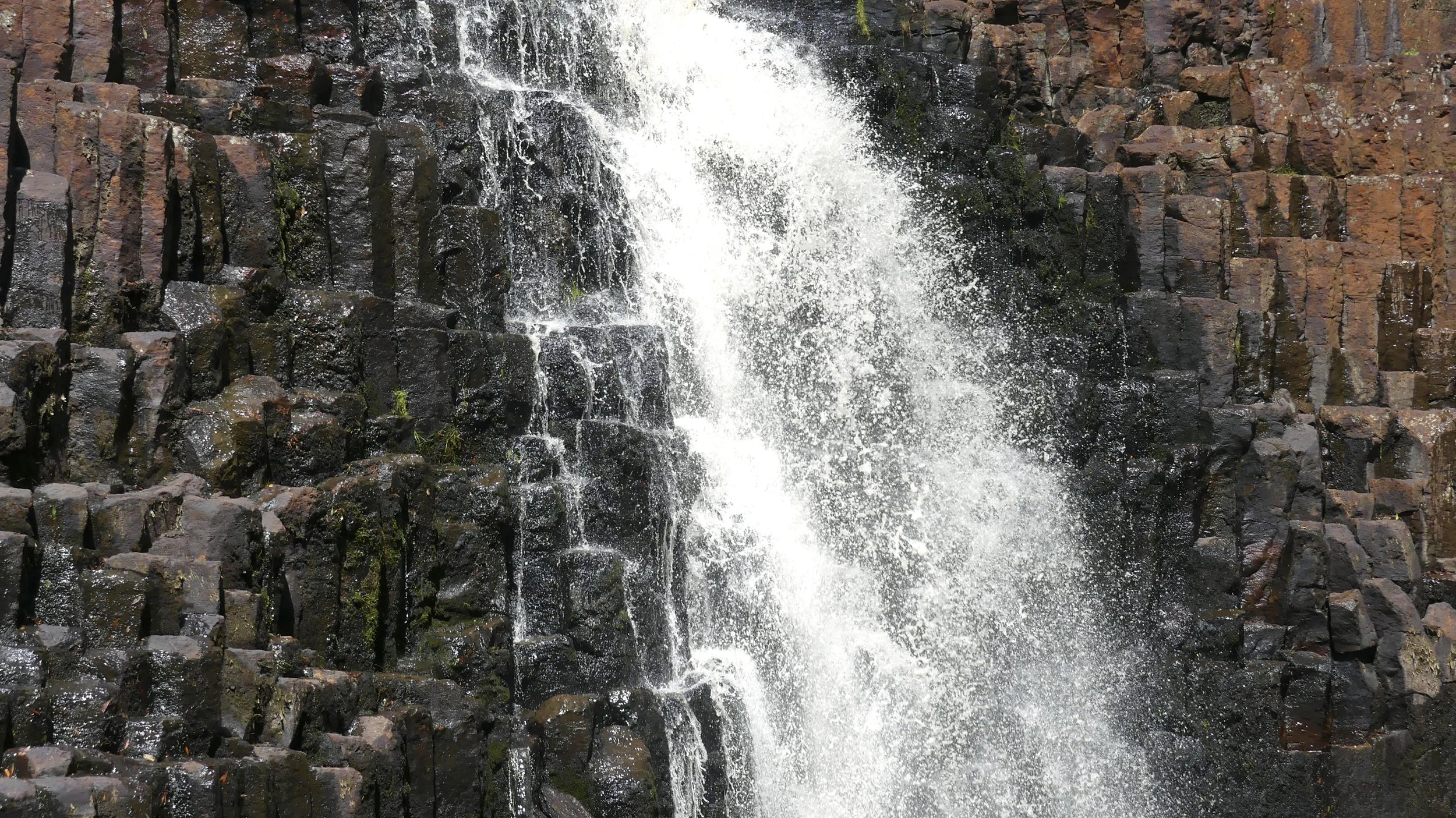
You walk through beautiful rainforest to reach Trowutta Arch, 30 minutes from Smithton. This unusual formation was created by the collapse of the ceiling of an underground cave as slightly acidic rainwater percolated down through carbonate bedrock above it, and the formation of a sinkhole to either side of the collapsed rock, one of them water filled. A sinkhole filled with water is called a cenote.

21 Masked Lapwings en route


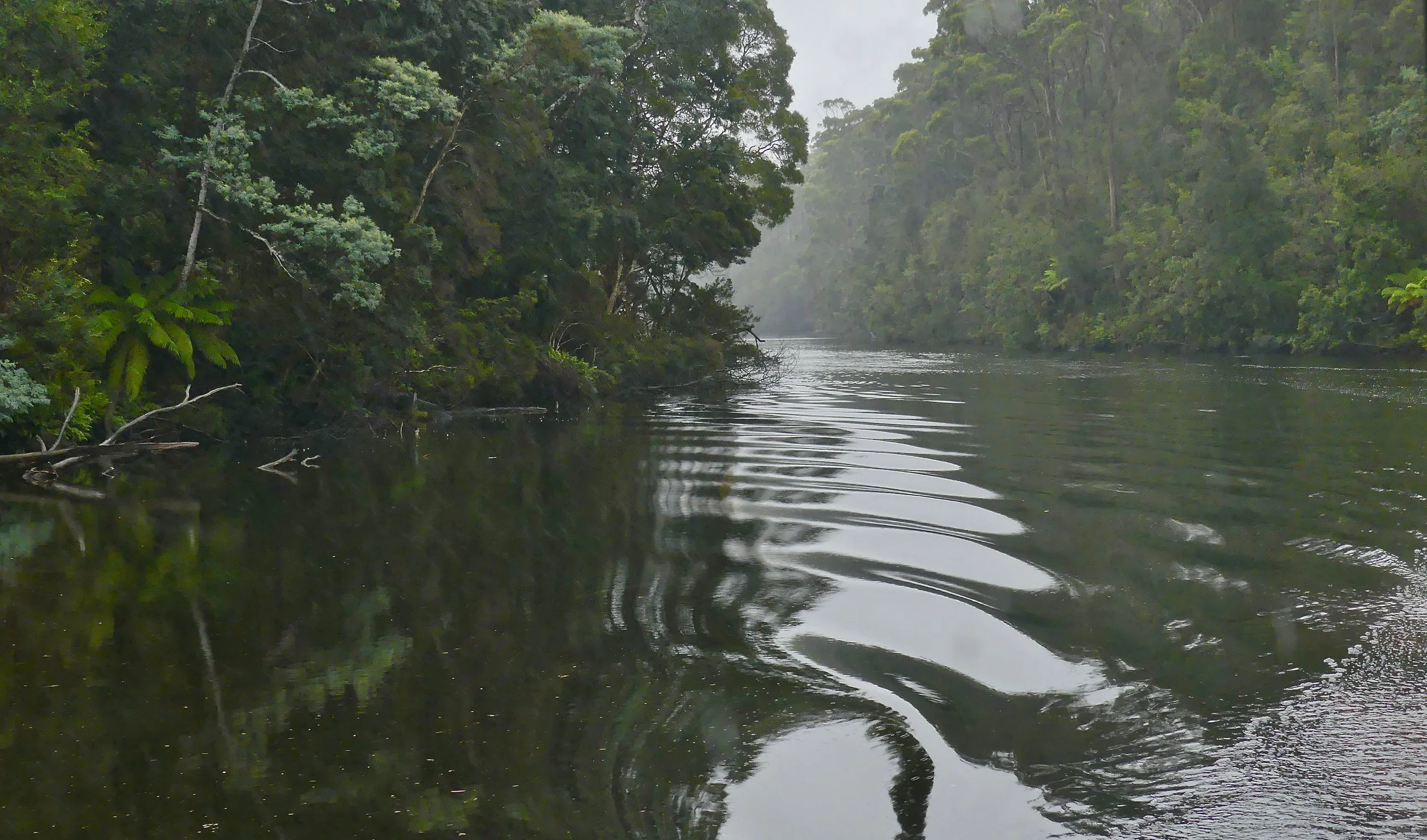
The Tayatea Bridge gave us our first view on this day of the Arthur River, quite a way east and upstream of the stretch we'd cruised the previous day.

A slow-going and bendy section of the C218 took us past another sinkhole, one that was even more difficult to photograph than at Trowutta Arch. Sinkhole country occurs in the dolomite karst, limestone scenery around the Trowutta and Black rivers. The rock is slightly soluble in rainwater so cracks and gaps underground are gradually enlarged, creating slumps and hollows on the surface. Not all hold water but this one did. It didn't seem to have a name, however, and our Tarkine Drive map was very approximate, but it's right by the road so you should spot it. If you reach Rapid River you've gone too far.
I've seen faster flowing rivers than the Rapid. I wondered briefly if they'd missed an 's' off, but friends of Bob Brown had been there so it was OK with me.


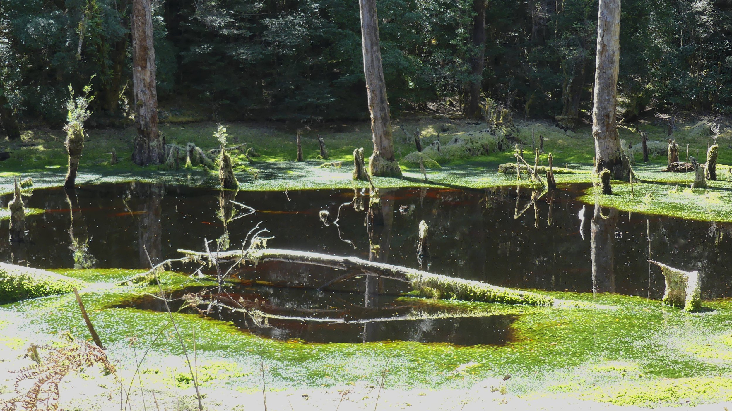
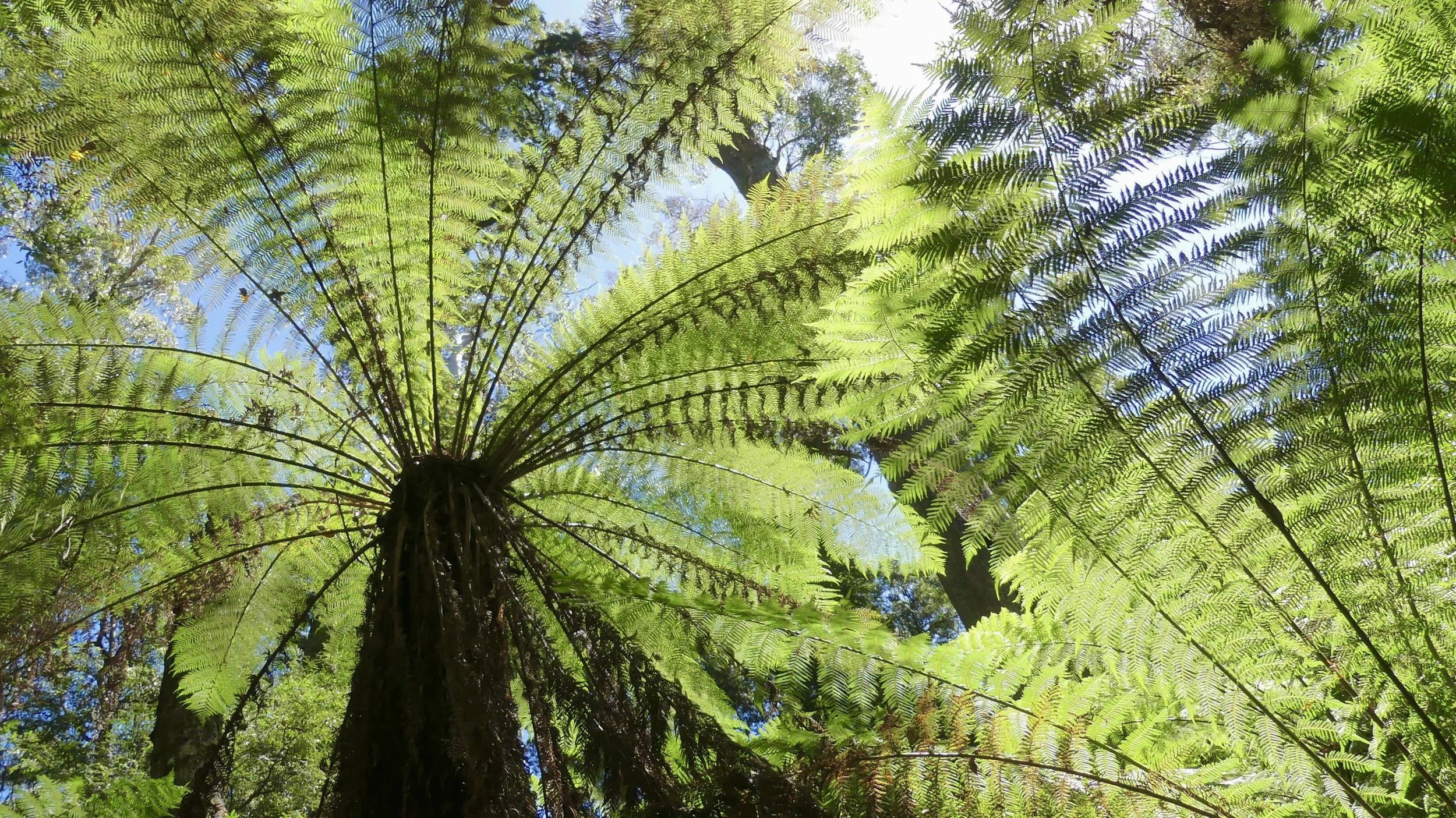
Lake Chisholm is only a short walk walk away from the road. Don't miss its tall trees and the beautiful peaty waters of one of Australia's finest examples of a flooded sinkhole. And there was yet another fern fest…


…which continued further down the road at Julius River.


We learned more about the Leatherwood, which is endemic and limited in range to the wet rainforest of the west coast of Tasmania. The tree isn't that tall, usually between two and ten metres, and in spring and summer produces small white flowers that have a strong, sweet fragrance. Leatherwood honey accounts for about 70 per cent of Tasmanian honey output. I think it's the best – a rich flavour but not too sweet or cloying or gritty. The name may come from the waxiness of young leaves or the timber's toughness, no one's really sure.


Paddle-shaped Leatherwood leaves

Above: random shelf fungus
Left: Leatherwood trunk
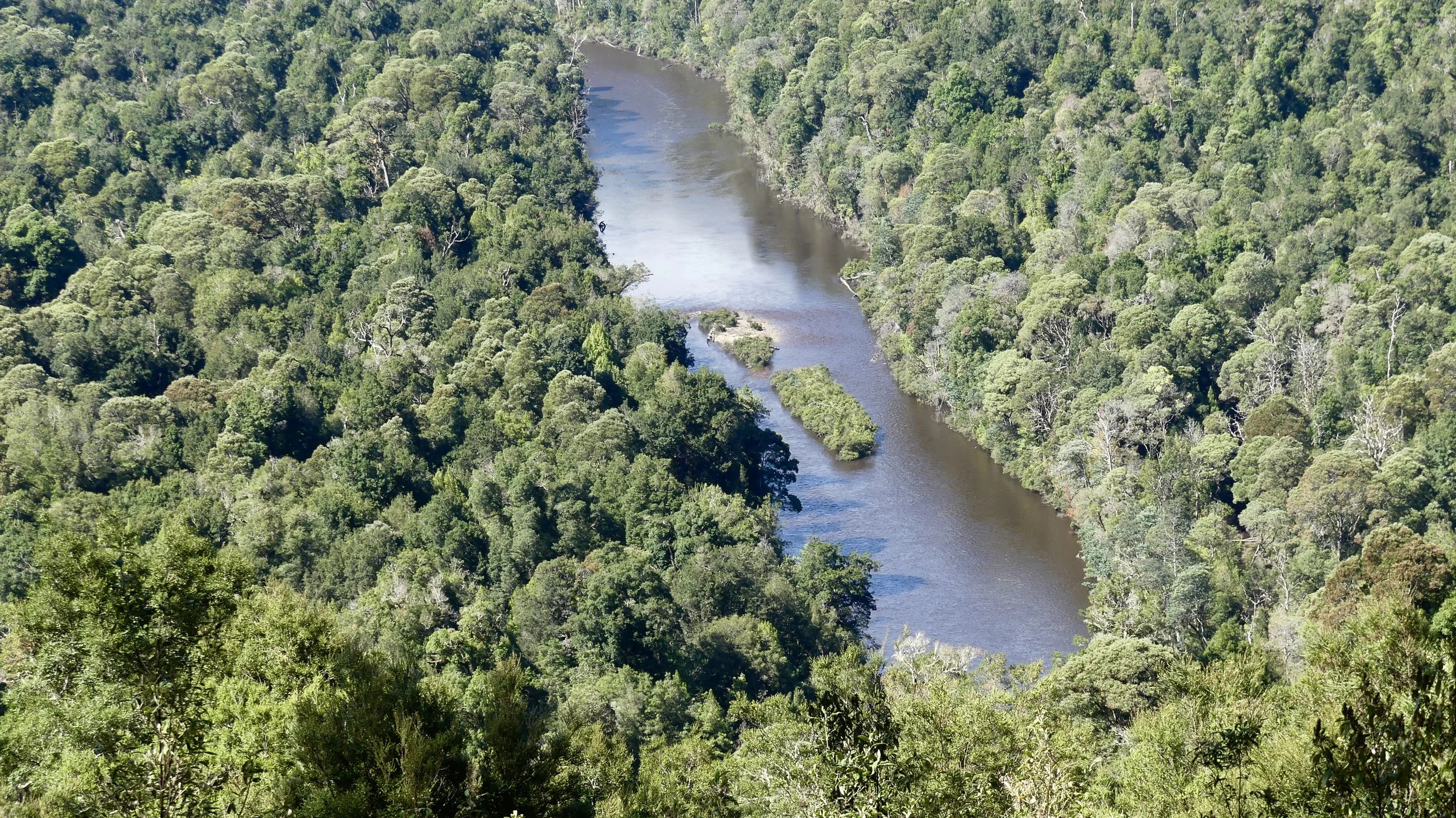
Finally, the Sumac Lookout provided a splendid view of the Arthur River, downstream from where we'd seen it earlier. The tallest trees, on the ridgeline to the right, are the eucalypts.

In the detail below, the darkest green crowns belong to the dominant species in cool temperate rainforest, Myrtle Beech. Also widespread is Sassafras, which has a bright green, conical-shaped crown, and Blackwood with its round, olive-green crown.

Tasmania's rainforest species go back more than 60 million years, to the break-up of Gondwana. They have been isolated for a relatively long time, during which there has been climatic change, so can be studied for their survival techniques. The state has 95 per cent of Australia's cool temperate rainforest, and the Tarkine has the largest continuous tract – more than 170,000 hectares. Cool temperate rainforest is different from tropical rainforest: the trees do not have buttress roots, and there are no palms nor climbing plants.
This globally significant forest must be protected at all costs, especially from 'speciality timber' logging and despite whatever minerals lie beneath. The campaign for a Tarkine National Park continues. Bob Brown tells people to go there. Then they'll appreciate why enforced protection is imperative, and pledge their support. Here's the link again.
* Post script Two weeks after this post was written this was the lead in The Saturday Paper, reinforcing my scepticism about forestry management generally and reporting deeply concerning air-quality breaches in Victoria.